Issue
A successful watershed management plan takes into account all forms of impervious surface, among other factors, within a watershed in order to create accurate volumes and rates for stormwater runoff. While datasets do exist to help classify land types, it’s not a perfect system and oftentimes additional information is needed for accurate coverage.
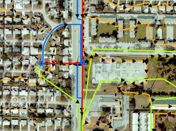
Process
In Pinellas County, Florida, watershed managers incorporated NOAA C-CAP land cover data, specifically for impervious surfaces, into their watershed management plan development process to enhance accuracy. These land cover data provided the footprint for roads and other impervious structures to create “directly connected impervious area” coverage values. These values are typically established based on land type. Prior to including the land cover data, the county regularly encountered areas that deviated from the established table values. Therefore, what county managers saw in the field was not always reflected accurately in the watershed management plans.
Impact
Through a watershed-wide approach and NOAA’s C-CAP data, Pinellas County is able to provide an accurate and cost-effective method to evaluate the capacity of a watershed to protect, enhance, and restore water quality and natural systems while achieving flood protection. (2023)