
The Takeaway: Collaboration tools and techniques for prioritizing nature-based project opportunities in a boundary-spanning planning process.
Overview
Learn how communities used Scaling Up Nature-Based Solutions (SUNS), a regional resiliency planning framework, to create a prioritized portfolio of nature-based solution investments. Chris Shepard, director of science at The Nature Conservancy, led the effort and describes the process she and partners used to help Florida Panhandle communities.
Lessons Learned
- Plan for implementation from the beginning. By thinking ahead, more projects are likely to be implemented. Bigger proposals across jurisdictional boundaries are better for successfully implementing nature-based projects at larger scales, but local governments do not necessarily have the time or interest to manage other municipalities' projects and grants. With some foresight, boundary-spanning organizations can help manage these cross-jurisdictional strategies to alleviate the operation concern.
- Have a planner on the team. “It’s essential to have someone with a planning background to manage the project," said Chris. For the SUNS project, this person was Anna Jane Jones, a NOAA Digital Coast Fellow. Anna had both conservation and community planning experience. Because there was not yet a process in place for project planning that spanned multiple counties, Anna’s experience was a key component of that work. Jones was also integral in coordinating the work, because a project of its size would most benefit from a full-time manager. This type of project requires coordinators to be readily available to build and maintain relationships, and became particularly important when Anna led the information gathering for user experience. These relationships helped to ensure that the maps are useful, usable, and understandable and include an accompanying narrative.
- Ask local organizations to be part of the team. Another reason for the successful project was the buy-in from local organizations and governments. Not only did the SUNS project have a large list of cities and counties participating, but the Northwest Florida Water Management District and the St. Andrew and St. Joseph Bays Estuary Program also joined the project leadership team. These local organizations were not only important to completing the project, but they are committed to continued work to advance nature-based projects in their region.
- Brainstorm projects in-person. Whenever possible, prioritize in-person meetings and brainstorming. Because of the COVID-19 pandemic, virtual meetings were necessary to bring together partners. Particularly for brainstorming and planning sessions, what had originally been interactive group brainstorming was being done at an individual level. Virtual meetings made it difficult to co-produce ideas among agencies, organizations, and local governments, and any collaborative project ideas needed several follow-up coordination conversations. The virtual get-togethers also resulted in a much longer project timeline. Still, some of these concerns for similar future projects will be alleviated now that the procedure is completed and much easier to replicate, including adapting materials and coordinating meeting processes.
The Process
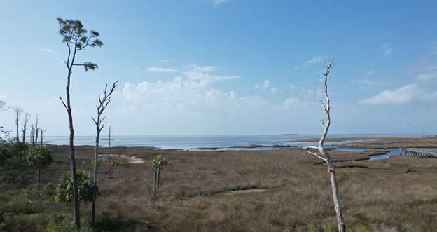
Scaling Up Nature-based Solutions (SUNS) was a multi-year effort to identify and promote nature-based solutions for resilience in the Florida panhandle. Driven by Hurricane Michael and to ensure nature-based solutions were considered in recovery planning, the SUNS team created a regional resilience planning framework. The Nature Conservancy, with support from Northeastern University and the United States Naval Academy, worked with the Northwest Florida Water Management District and St. Andrew and St. Joseph Bays Estuary Program to use nature-based solutions to tackle challenges like flooding, sea level rise, threats to wildlife, and economic development. The project brought together local stakeholders and other regional, state, and federal partners to identify and guide investments to implement the best natural solutions to the unique challenges facing Bay, Gulf, and Franklin Counties.
Understanding Local Needs
The Nature Conservancy’s Chris Shepard and her colleagues worked with Darryl Boudreau from the Northwest Florida Water Management District to conduct a needs assessment to best understand the region's capacity, and where support is needed to implement nature-based solutions. The team worked through existing relationships in the Panhandle region to conduct interviews and meetings with 43 people. Participants were identified through snowball sampling, which involves interviewees suggesting additional contacts.
The assessment
- helped establish connections with local, state, and federal agencies;
- identified potential members for the SUNS working group;
- gauged interest in nature-based solutions;
- assisted the team with understanding the planning that had been accomplished to date; and
- assessed project development needs.
One of the major findings from the assessment and the foundation for the SUNS project is that communities, especially during recovery, don’t always have the capacity to consider the best places to use nature-based projects or work across municipal boundaries to implement these types of projects and therefore reap the longer-term benefits.
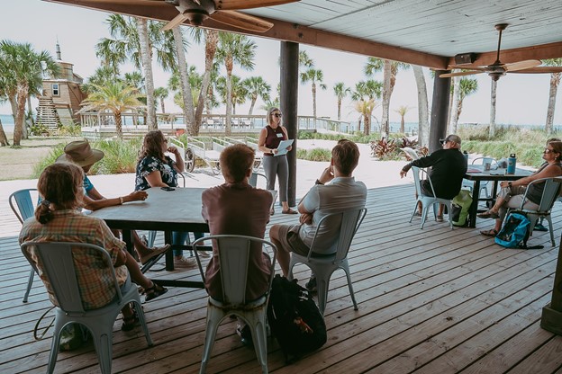
Convene a Working Group
The Nature Conservancy staff, along with Northwest Florida Water Management District partners, worked with Northeastern University, the U.S. Naval Academy, and the St. Andrews and St. Joseph Bay Estuary Program to develop a working group that included local governments, regional planning councils, state agencies, and local stakeholders. The working group guided the project and provided expertise.
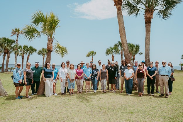
The group was instrumental in identifying the hazards to be addressed and priority locations within each community, defining guiding principles and regional strategies for prioritizing nature-based solutions, and pinpointing the projects that should be planned for. The hazards identified include storm surge, coastal and riverine flooding, erosion and shoreline recession, and sea level rise. Many nature-based solutions were considered to mitigate the hazard impacts; some examples include beaches and dunes, living shorelines, wetland migration corridors, conserving greenspace, and built stormwater infrastructure improvements. While originally planning to convene three to four workshops over six months, the COVID-19 pandemic significantly extended the timeline. The group met monthly during shorter virtual meetings.
Building the Portfolio
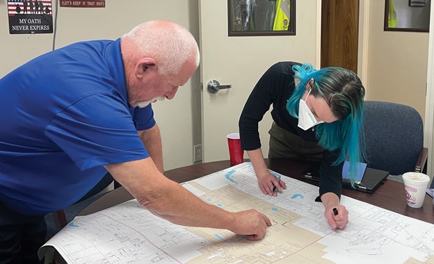
Using the needs assessment and working group feedback, the SUNS project team incorporated information into “opportunity maps” for each identified nature-based solution. These maps show where along the Florida panhandle each nature-based solution is suitable to be implemented, is in an area of coastal risk, and in an area of medium or high value for fish and wildlife habitat. These maps helped the working group focus the conversation and prioritize areas of high impact, but did not include projects outside the mapped boundaries.
These opportunity maps and a compilation of additional supporting layers were displayed on the online mapping tool, the SUNS Map App. Other data layers included the Florida Forever areas, critical infrastructure, sea level rise projections that align with Resilient Florida requirements, NOAA’s Coastal Flood Hazard Composite layer, the Southeast Conservation Blueprint data showing priority habitat areas, the Center for Disease Control’s social vulnerability data, and the “Existing Plans and Projects Footprint Map,” created during the needs assessment.
The working group hosted a four-part virtual workshop series using the SUNS Map App to develop potential nature-based solution projects across the region. The workshop series focused on a particular topic for each review cycle and included greenspace in the floodplain, community stormwater management, shoreline protection, and regional recreation economy. The working group members reviewed the SUNS Map App layers and suggested potential projects to mitigate the earlier identified hazards and future impacts, and consider recreational opportunities and economic development.
The workshop series resulted in 143 potential projects added to the SUNS Map App. To better prioritize and narrow the number of projects, the following screening criteria were used:
- Nature-based
- Benefits commercial and residential structures
- Benefits critical infrastructure
- Benefits potentially vulnerable communities
- Aligns with state and regional habitat priorities
- Aligns with hazard zone footprint from NOAA Flood Exposure Composite Layer
- Provides potential recreational amenities
After applying these criteria, through reviewer scoring and GIS analyses, and allowing for adjusted scores based on local knowledge and feedback from the working group on project preferences, agreement between the working group and SUNS project team resulted in a final list of 72 nature-based solution projects, 11 plans or assessments, and five connector projects like parks or trails. The SUNS Project Dashboard is now available to the public, showing the project ideas and primary project types. The SUNS team will provide capacity and support to advance as many projects as possible toward completion through at least 2024.
Next Steps
To ensure the project proposals are implemented for the Florida Panhandle, Chris mentions potentially partnering with other organizations to integrate nature-based solutions in ordinances and planning documents, as well as researching funding mechanisms for smaller projects. Additional information on the successful implementation of proposals for this original project can be found in the SUNS report.
Additionally, the team is interested in replicating the SUNS project in other areas of the Gulf Coast in underserved communities with high opportunity for nature-based solutions. In the Perdido watershed of the eastern Alabama western Florida shoreline, The Nature Conservancy is using a NOAA Transformational Habitat Restoration and Coastal Resilience Grant to increase climate resilience as part of the Perdido Watershed Habitat and Community Resilience Initiative. A small portion of the project will include replicating the SUNS process in the watershed, using a similar working group starting in 2024.
In Louisiana, The Nature Conservancy developed nature-based solutions opportunity maps to align with the Louisiana Watershed Initiative, a project working across nine watersheds to mitigate flooding. To increase the number of nature-based solution proposals for the initiative, The Nature Conservancy is helping to educate the communities on how to use the opportunity maps to develop nature-based solutions project ideas.
Contributing Partners
- City of Apalachicola, Florida
- Bay County, Florida
- City of Callaway, Florida
- City of Carrabelle, Florida
- Emerald Coast Regional Council
- U.S. Environmental Protection Agency
- Florida Department of Environmental Protection
- Franklin County, Florida
- Florida State University Panama City
- Florida Fish and Wildlife Conservation Commission
- Gulf County, Florida
- City of Lynn Haven, Florida
- City of Mexico Beach, Florida
- NOAA
- U.S. Navy
- Northeastern University
- City of Panama City, Florida
- City of Parker, Florida
- City of Port St. Joe, Florida
- City of Springfield, Florida
- Tyndall Air Force Base
- University of Florida
- U.S. Fish and Wildlife Service