NOAA Provides Assistance to Coastal Communities
The Takeaway: Some U.S. coastal communities have plentiful data for creating robust resilience plans. Others are struggling to catch up. NOAA’s Office for Coastal Management is focused on providing equal access to the data, tools, and expertise they deserve.
For decades coastal communities with data needs large and small have turned to the NOAA Office for Coastal Management for help. Many are underserved technologically, for reasons that range from geographic isolation and a scarcity of data to a shortage in the funding, or partner networks, needed to get the job done. NOAA takes a special interest in these communities and works to bridge the gaps in data, tools, and maps. See the stories below for examples.
Helping remote villages increase resilience
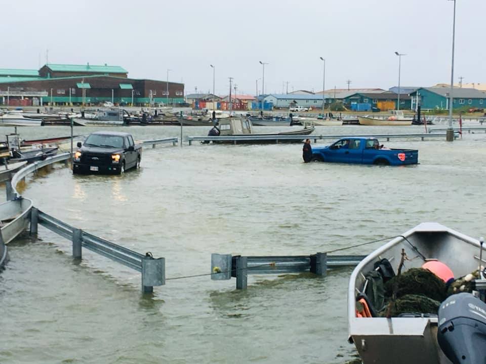
Alaska
Alaska’s sprawling coastline—6,640 miles, not counting many islands—features remote, Native Alaskan villages that face severe, climate-change-related dangers to life and property. In the past, their isolation meant a lack of access to technical experts and data. Now partners in two projects will equip 50-plus remote Alaska communities with the data and maps they need to minimize threats from worsening storm surge, sea level rise, and shoreline erosion.
Major achievements include flood-risk maps and a cost-effective strategy to collect water-level information in isolated areas. Project partners include the National Coastal Resilience Grant and NOAA’s Center for Operational Oceanographic Products and Services, Coastal Geospatial Services Contract, and Digital Coast.
Informing climate-ready infrastructure
Mississippi
In Mississippi, the Jackson County Utility Authority was faced with a crucial decision—where to locate a new, state-of-the-art facility for collecting, treating, and repurposing wastewater. Choosing wisely could mean avoiding millions of dollars in repair costs, something officials learned the hard way when flooding from 2005’s Hurricane Katrina and 2017’s Hurricane Nate greatly damaged two aging facilities.
Using NOAA’s Sea Level Rise Viewer, the facility project team chose the new site by exploring areas that will remain dry for the next 50 years at medium-to-high sea level rise scenarios of three to five feet. This choice ensures that wastewater infrastructure dollars are spent wisely and with future generations in mind. Eventually sea level rise data will be combined with storm surge data, from NOAA’s National Centers for Coastal Ocean Science, to determine the height of any protective berms needed around the new facility.
New Hampshire
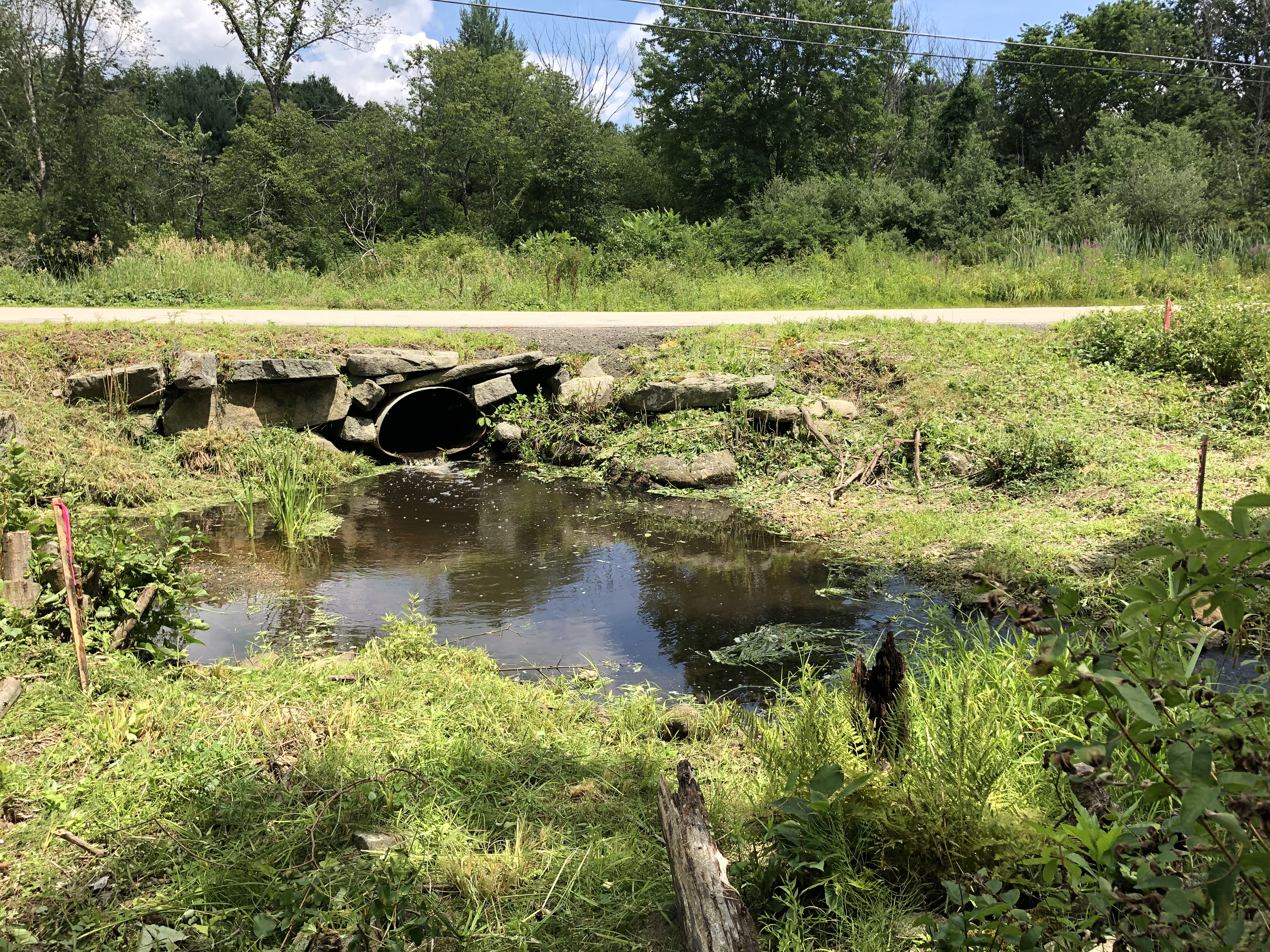
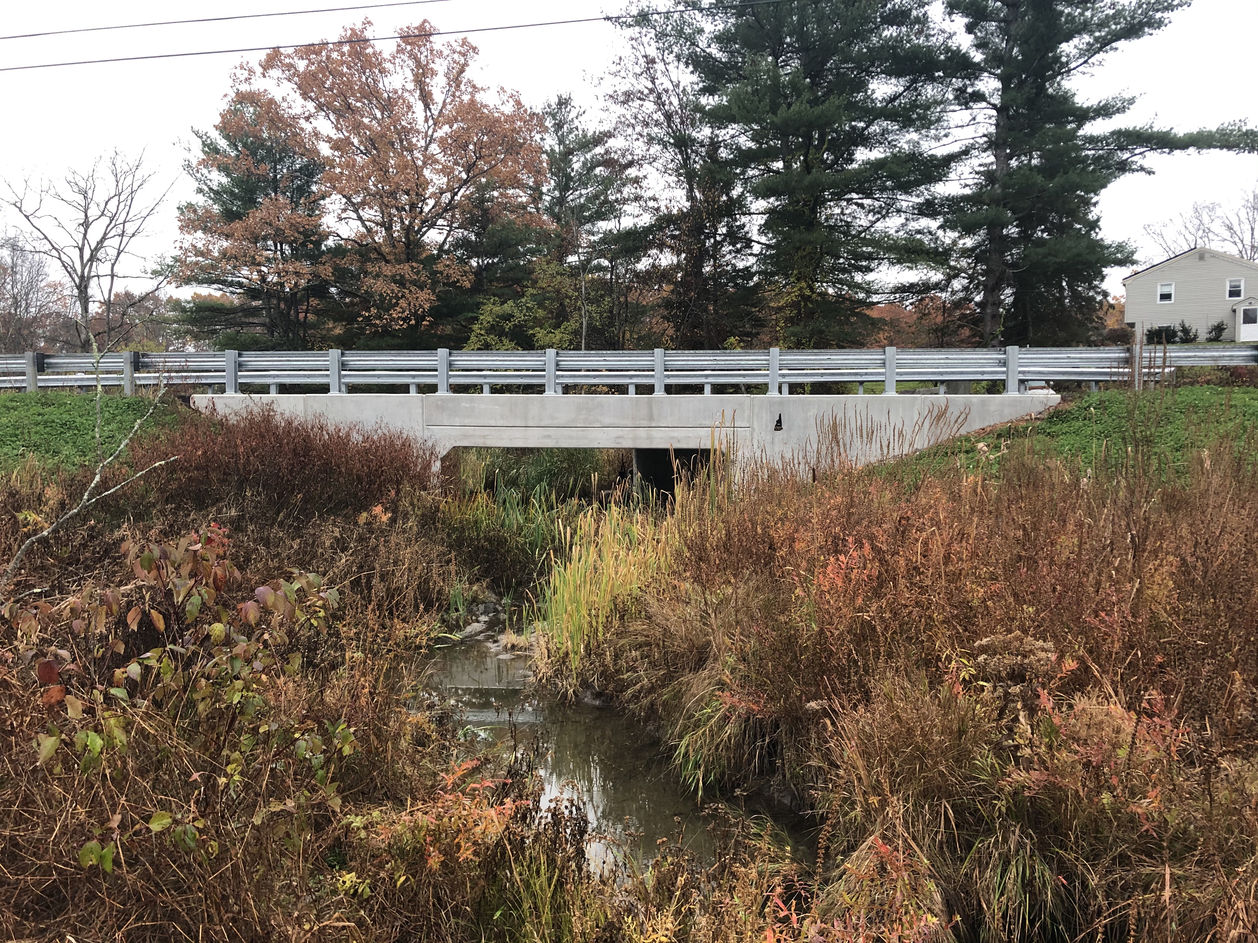
Not long ago, floodwaters from heavy rainfall and high tides would overtop an aging culvert and spill across a nearby roadway, endangering drivers in Newmarket, New Hampshire. Like coastal officials with limited budgets everywhere, those in New Hampshire are seeking ways to upgrade aging waterway infrastructure as climate change intensifies.
Today in Newmarket, a modernized culvert in place of the old one is large enough to repel the coming century’s highest tides and “100 year” flood conditions. The new design enables fish to swim upstream from Great Bay to critical rearing habitat for the first time in decades. More tidal crossing fixes are on the way, thanks to a state partnership that assessed 188 crossings and prioritized some for repair. The Nature Conservancy and New Hampshire Coastal Program co-led this multi-partner effort with support from NOAA’s Office for Coastal Management.
Making all voices count
Virginia
By 2026, the largest offshore wind energy facility in federal waters will power roughly 650,000 homes from Virginia Beach to Richmond. When the news was announced, people with a stake in area fisheries and marine life expressed concern about their ability to keep informed and, when needed, weigh in on potential siting locations.
The development of a data portal made project information and feedback easier to access, including maps on recreational fishing areas, marine life, migrating birds, and more. The Virginia Coastal Zone Management Program initiated the data portal in 2009, led efforts encouraging stakeholder dialogue, and supplied a variety of ocean-use maps and data sets. The Mid-Atlantic Regional Council on the Ocean administers the portal today. Many partners from government, academia, and the private sector are making this project possible.
Advancing disaster readiness
Washington
Padilla Bay, a haven for wildlife and aquatic life in Washington State, is flanked by oil refineries, oil and natural gas pipelines, and a railroad and highway that transport oil and refinery products. An upgraded disaster-response plan is motivating state officials to fine-tune some oil spill procedures. The Padilla Bay National Estuarine Research Reserve contributed to the upgrade by providing tide-level information and a digitized navigation map that will aid future responders piloting their vessels through winding bay channels.
NOAA’s Office of Response and Restoration instructed partners on how to assess damages and aid incident responses. Tribal partners, oil-industry experts, other disaster responders, and several agencies contributed information and skill-building exercises to this effort.
U.S. Virgin Islands
For years, the U.S. Virgin Islands Coastal Zone Management Program continued to map sunken vessel locations, even though funding was not available to remove the vessels. In 2017 Hurricanes Maria and Irma sank 400 vessels, creating environmental havoc and blocking cargo ships from bringing urgently needed supplies.
The coastal program’s maps enabled the U.S. Coast Guard to quickly remove sunken vessels while avoiding injuries from debris and pollutants. Today, even the vessels that had languished for years before 2017 pose no more danger to marine life, coral reefs, or the public.

To learn more about these and other NOAA resources, view the Office for Coastal Management site or email coastal.info@noaa.gov. (2021)
Partners: Alaska Department of Natural Resources’ Division of Geological and Geophysical Surveys; Alaska Ocean Observing System; Alaska Sea Grant; Alaska Water Level Watch; Dominion Virginia Power; Jackson County Utility Authority; Marathon’s Shell and Andeavor refineries, Mid-Atlantic Regional Council on the Ocean; National States Geographic Information Council; New Hampshire Department of Environmental Services Coastal Program; Pacific Northwest National Laboratory; Padilla Bay National Estuarine Research Reserve; Samish Indian Nation; Swinomish Tribe; The Nature Conservancy; University of Alaska Fairbanks; University of New Hampshire; University of New Hampshire Technology Transfer Center; Virginia Coastal Zone Management Program; Virginia Department of Mines, Minerals, and Energy; Washington Department of Fish and Wildlife; Washington Department of Ecology; U.S. Virgin Islands Coastal Zone Management Program; NOAA’s Center for Operational Oceanographic Products and Services, Digital Coast, National Centers for Coastal Ocean Science, Office for Coastal Management, and Office of Response and Restoration; and the U.S. Army Corps of Engineers, Bureau of Ocean Energy Management, Coast Guard, and Environmental Protection Agency
PRINT