Issue
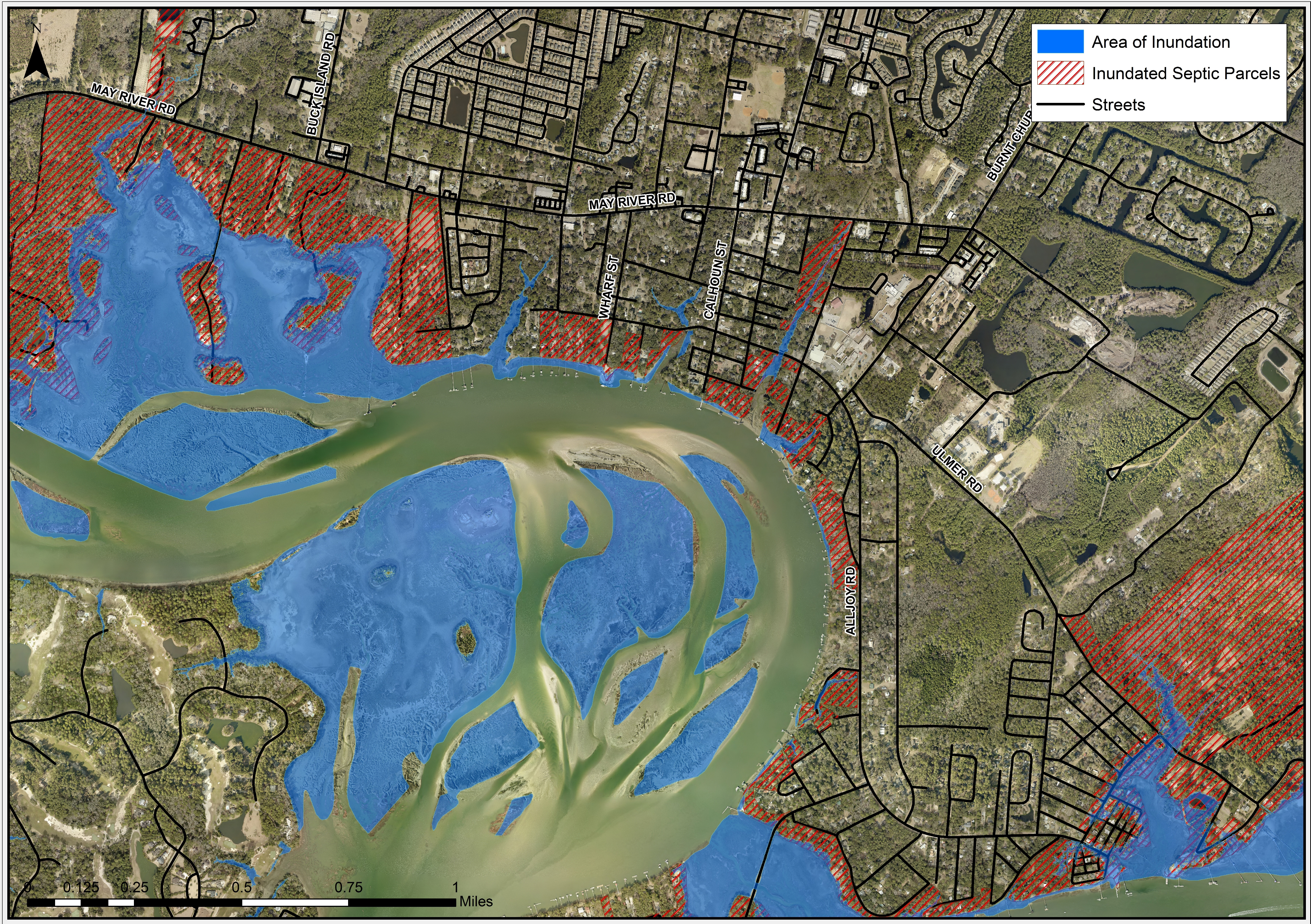
The town of Bluffton, South Carolina has been experiencing high tide flooding due to recent extreme tide events in areas that had previously not been flooded. While some of this flooding is short-term, causing mainly driving hazards, other effects, such as infrastructure damage and health concerns from septic contamination, have more long-term impacts.
Process
To help identify the vulnerable infrastructure and septic systems, the GIS staff with the town of Bluffton’s Watershed Management Division used NOAA’s sea level rise methodology. Staff modified the model by incorporating the town’s most updated data to produce a more accurate local assessment. After using model scenarios based on local tide data and observed extreme tide measurements, GIS staff then performed spatial analysis to identify potential flood impacts to the jurisdiction.
Impact
The town is using the results of this analysis to prepare for future events. Town planners will consider them in future development decisions to help minimize the impacts of increasing tidal flooding. In addition, the town’s Watershed Management and Capital Improvements Program divisions are using these results to prioritize areas for conversion from septic to sanitary sewer, as well as in the design of infrastructure improvements to create more resilient projects. (2017)

