Tools Used
These guidelines were taken from the following websites and publications:
Sea Level Rise and Coastal Flooding Impacts Viewer's Flood Frequency Section
National Weather Service Local Flood Threshold Guidelines
Inundation Analysis Tool
Inundation Analysis Tool Users’ Guide
Advanced Hydrologic Prediction Service
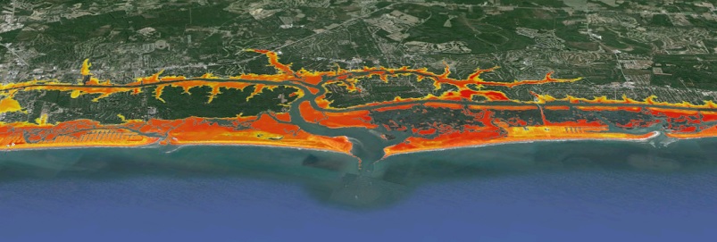
Case Study: Charleston, South Carolina
-
Obtain the Flood Threshold Guidelines Used in Your Study Area
Tide gauges measure water levels. In official terms, a quantifiable coastal flood advisory occurs when water levels exceed the levels stated in the flood threshold guidelines. These guidelines are set by the local weather forecast offices of the National Weather Service. The warning coordination meteorologist or staff hydrologist in the local office should have the tide gauge and threshold information, or the data may be found on the Advanced Hydrologic Prediction Service section of the National Weather Service website, if available.
NOTE: Some weather forecast offices may use non-NOAA (private, U.S. Geological Survey, etc.) tide gauges for forecasting water levels; information from non-NOAA sources may not work when calculating flood frequency and duration with the method provided in this “how-to” guidance.
-
Calculate Total Water Level
Go to the Inundation Analysis Tool website, navigate to the study area tide station using the map interface, and click on the link in the pop-up box to access the tool. To get the total water level, add the National Weather Service coastal flood threshold level from the first step to the mean lower low water (MLLW) datum height found in the datums listings. Note the units are in meters for the tool, so a conversion may be necessary when adding the flood thresholds that are primarily given in feet. This information is also available from the local National Weather Service office.
Equation: National Weather Service-provided flood threshold + station “mean lower low water” datum = total water level used for coastal flood advisories
When this elevation is reached, or predicted to be reached, the National Weather Service will issue a coastal flood advisory.
-
Calculate Inundation Statistics for Specific Time Period
Still in the Inundation Analysis Tool, enter the total water level value as calculated in step 2 into the User Specified Elevation box located below the tidal datum elevations table.
Specify a date range* for analysis by selecting a begin date (Month/Day/Year) and end date (Month/Day/Year), and then click the Submit button.
The results will list each tide exceeding the threshold, along with tide elevation, type, and individual duration. A summary of flooding statistics, including the number of events and hours inundated, can be found above the individual listings. Plots are also available to view for comparing the flood statistics.
*Data may be queried for a maximum date range of five years, and a minimum of one month.
Resources:
-
Factor In Increased Sea Level Rise
Create scenarios of increased sea level rise by subtracting* the predicted sea level rise from the “total water level.” Make sure the units of sea level rise match the total water level units (meters).
Equation: Total water level – predicted sea level rise = flood threshold with sea level increase
Enter new value into the Inundation Analysis Tool’s User Specified Elevation box and click Submit. Note the increase in high tides at flood stage and total duration (hours) of flooding.
Investigate different scenarios by subtracting additional increments to develop a comparison data set.
*Although you are factoring in sea level rising, the total water level value used for this analysis will decrease. With sea level rise, the water level base, or zero datum, moves up, while the flooding threshold stays the same, causing the analysis threshold to become a lower number.
Resources:
-
Analyze Increased Sea Level Data
After the chosen parameters have been entered, a listing will appear that will include station name and ID, time period selected, reference datum and value, number of high tides analyzed, total hours of inundation above specified elevation, and the number of missing six-minute data points over the selected time period, if applicable.
Keep in mind that these data do not factor in the compounding effects of onshore flow, low pressure, or precipitation.
Resources:
-
Plot Data in Graphic Applications for Comparison
Select one of three options in the top right-hand corner of the page to graphically display summary statistics obtained in step 5. The options include
1. Frequency of Elevations
2. Frequency of Durations
3. Duration vs. ElevationResources: