Issue
As global climate change impacts the U.S. Pacific Islands in distinctive ways, studying the past may provide important lessons for today on human resilience and resource conservation. On the small islands of Ofu and Olosega in American Samoa, researchers used high-resolution lidar and other modalities to locate archaeological sites and learn more about how island settlers thousands of years ago responded to sea level fluctuations and other environmental changes.
Process
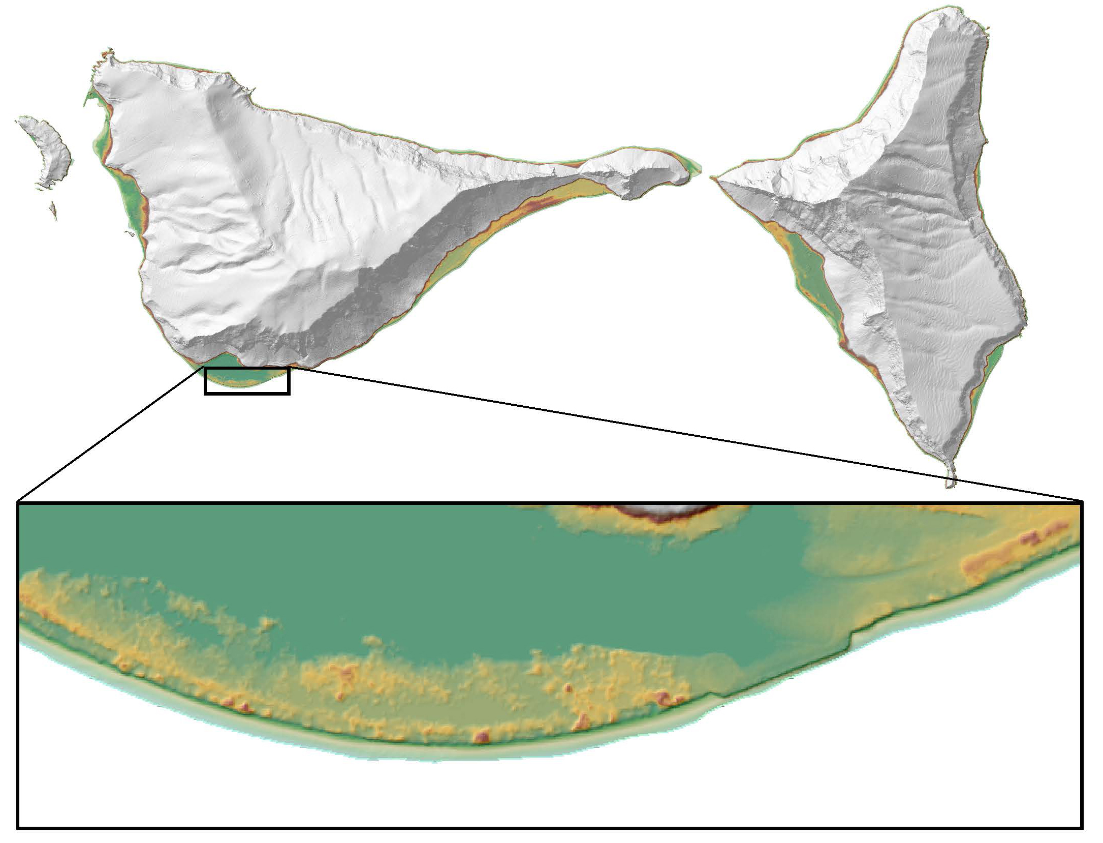
High-resolution lidar data covering the immediate coastline and interior of Ofu and Olosega enabled the research team to model terrain in key locations, identify ancient beach ridges reflecting sea-level change, extract landscape and structural features, and predict and locate archaeological coastal settlements. In addition, elevation data helped the team track changes in these coastal settlements through time. Lidar data of island interiors allowed researchers to study past human-environment relationships that took place throughout American Samoa’s islands. The interdisciplinary research team was from North Dakota State University and specialized in archaeology, geology, spatial analysis, and remote sensing.
Impact
The lidar data led to the discovery of an archaeological site on Ofu Island that appears to have been inhabited at, or shortly after, initial colonization thousands of years ago. Lidar-derived elevation data of the excavation site enabled researchers to model the landscape and paleoenvironment during periods of past sea-level change. The research team found that over the first millennium A.D., Ofu’s western coast had moved 150 to 200 meters toward the sea because of accumulated sediment, and this caused significant changes to both the terrestrial lowlands and shallow marine environments of the island. Archaeological features identified through the lidar suggested that people began to live permanently in Ofu’s interior as the coastline change brought a decreased emphasis on acquiring marine resources. The sheer number of inland features identified by lidar images suggests that the prehistoric population was much larger than that of today, indicating that ancient agricultural practices were highly productive. The evidence revealed that island residents stayed resilient to coastal changes by introducing flexibility to food production and food collection systems, thereby adapting to their changing environment over the first millennium A.D. These findings and possible lessons for today will serve as essential context for communities in American Samoa that are considering climate adaptation plans and decisions. (2016)