Issue
The California coastline is at risk from powerful storm surges and more frequent and intense flooding. California is particularly vulnerable to sea level rise because approximately 80 percent of the population lives within 30 miles of the Pacific Ocean. The California State Lands Commission, which manages and leases California’s tidelands and submerged lands, wanted to help coastal communities prepare for rising seas.
Process
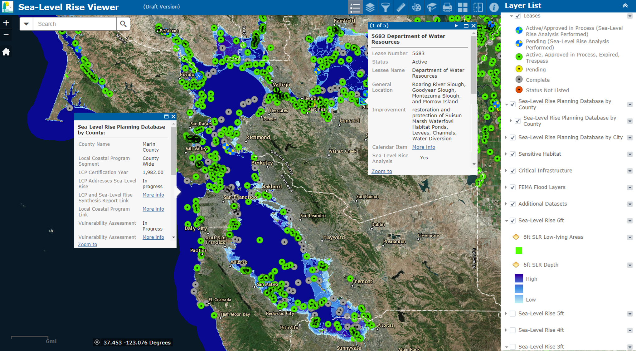
To begin, the State Lands Commission developed its own comprehensive, interactive sea level rise viewer to help agency staff members and lessee partners understand potential risks to infrastructure, natural habitats, and coastal communities. The tool informs and educates lessees by identifying vulnerabilities and impacts from different sea level rise scenarios and helps agency staff members make more informed, data-driven decisions about critical resources along the coast. Sea level rise data and map services from NOAA’s Sea Level Rise Viewer and other Digital Coast data such as seagrass distribution, canopy forming kelp, critical habitat designations, and shoreline data were integrated into the tool, along with additional relevant datasets such as critical infrastructure and NOAA tide stations.
Impact
State Lands Commission staff are now able to visualize and compare various sea level rise scenarios at different scales along the California coast, as well as overlay sea level rise, sensitive habitats, critical infrastructure, and social and economic data, onto a lease area for a more comprehensive picture of vulnerability. With the assistance of the State Lands Commission’s viewer, staff are better able to examine what Public Trust resources and assets are at risk from sea level rise and communicate those risks to lessees and the public. The desired outcome is for lessees to understand in greater detail the impacts of sea level rise, and plan adaptation strategies that avoid, minimize, or mitigate the risks to their property and public trust lands.