Issue
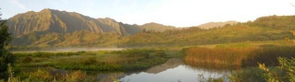
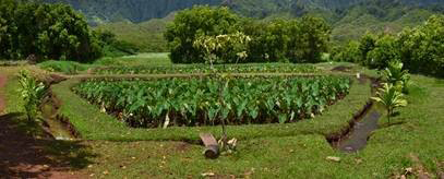
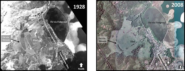
The He’eia wetland and fishpond on the eastern side of O’ahu, Hawai’i, was historically a thriving agricultural area with healthy native wetland habitat, high concentrations of wet taro farming, and a highly productive fishpond. These lands once supported large populations throughout the island but today are severely degraded by invasive species and sedimentation caused by a discontinuation of traditional water and land management practices.
Process
Discovering how the He’eia wetland, fishpond, and adjacent areas were managed historically would inform current restoration plans. To do this, the Kāko’o ’Ōiwi, a local nonprofit organization, partnered with The Nature Conservancy, The Ko’olaupoko Hawaiian Civic Club, and the Office for Coastal Management – Pacific Islands to conduct workshops with the kūpuna, or native Hawaiian elders, who grew up in He’eia. Thirteen kūpuna living in the area since the 1920s provided geospatial and other information on how wetlands, fishponds, water, and agricultural areas were sustainably managed. Spatial data were collected on portable tablets using ArcGIS and were supplemented through the informal process of “talk-story” narratives, which were captured using audio and video equipment.
Back in the old days all the streams in the area were “. . . crystal clear. You could stick your head in the streams and drink.”
Impact
The information shared by kūpuna will be used to guide restoration efforts in the area. Restoring the area is ongoing work that will provide food security, restore native wetland habitat, and maintain the practice of Hawaiian culture.