Issue
Sea level rise is widely recognized as a significant threat to human health and safety, the economy, wildlife, and natural habitats. Understanding the issue is the first step toward addressing it. While authorities and coastal zone managers must stay informed, they are not the only members of a community who should do so. To help prioritize and plan for sea level rise, storm surge, and changing ocean conditions, the public needs to understand the issue and its implications.
Process
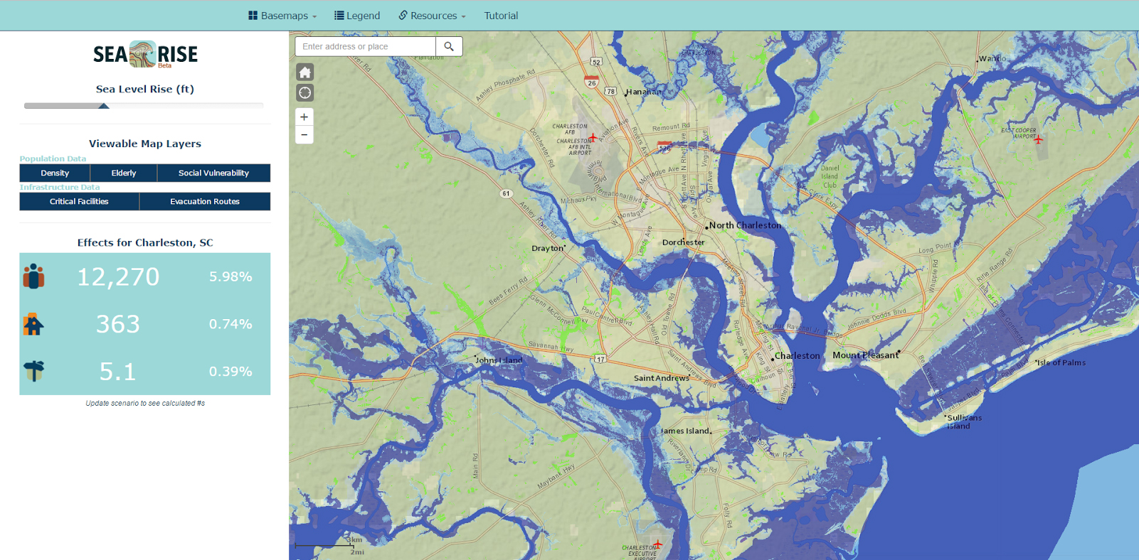
To better inform and engage the public, the South Carolina Aquarium created the Resilience Initiative for Coastal Education project, with the goal of developing a resilience strategy for communities in the southeastern Atlantic bight region. An important component of the initiative is SeaRise, a responsive web application designed to quickly and easily show the public how sea level rise will affect them.
Using data and map services from a popular NOAA tool, the Sea Level Rise Viewer, the application, which functions on mobile devices and adapts to any screen size, conveys complex information in an accessible way. The tool, built by ROK Technologies, permits easy visualization of the potential direct impacts of various scenarios, allowing people to see if and how coastal flooding will affect their homes, workplaces, and neighborhoods. Additionally, SeaRise uses U.S. Census data to help identify areas with higher population density or more vulnerable residents (such as the elderly). By using Sea Level Rise Viewer data, it can calculate the approximate number of homes, people, and businesses that could be impacted.
The SeaRise tool aims to promote public safety and engagement, filling a void in public knowledge of issues related to sea level rise while advancing discussion about the issue.
Impact
An easy-to-use application that can be accessed on any computer or mobile device, SeaRise can reach a broad audience. As the city of Charleston’s most visited attraction, the South Carolina Aquarium receives tens of thousands of visitors each year, providing many opportunities to inform the public about the tool. Beyond that, through the aquarium’s partnerships, donors, and word of mouth, the SeaRise tool has the potential to educate and engage countless citizens throughout the region. (2017)