Challenge
Officials in Sheboygan County, Wisconsin, were considering restoring wetlands in order to manage water pollution—thereby improving water quality—and reduce flood risks. They needed to identify which sites had the most potential for these purposes.
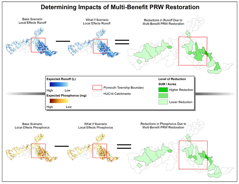
Solution
The team used QNSPECT, a screening tool on the Digital Coast, to model land use scenarios, the results of which were used for an assessment that identified areas that contribute high levels of pollution, as well as wetlands that have the potential to provide the most water quality and flood protection benefits. The results pinpointed the best restoration sites for their needs, and also helped determine the impacts of future development.