Issue
The Biden-Harris administration has a goal of deploying significant offshore wind capacity by 2030. Finding areas for offshore wind development in an already busy ocean is challenging, and the goal is to find the areas that are suitable while minimizing conflict with other ocean uses. This process, called marine spatial planning, takes a lot of engagement with interested parties and data to understand existing ocean uses and conditions.
Process
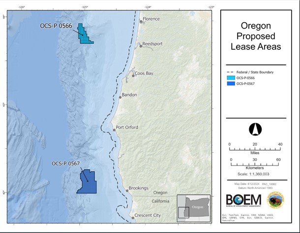
The National Centers for Coastal Ocean Science (NCCOS) provided spatial modeling support to the Bureau of Ocean Energy Management (BOEM) to create a comprehensive, ecosystem-based ocean planning model for Oregon. The model used trusted data from Marine Cadastre, including Wrecks and Obstructions, Weather Radar Impact Zones, Aids to Navigation, AIS Vessel Transit Counts, and Vessel Routing Measures in combination with other fisheries, national security, oceanographic, and natural resource data to aid in selecting the final wind energy areas.
Impact
Wind energy area development is a crucial part of the Biden administration's plan to deploy 30 gigawatts of offshore wind energy capacity by 2030 and 15 gigawatts of floating offshore wind by 2035. The authoritative data provided by Marine Cadastre supported NCCOS spatial suitability modeling to help define the areas offshore Oregon that hold the potential for 2.4 gigawatts of clean renewable energy. (2024)