
The Takeaway: Learn how one state agency is working with coastal municipalities to assess local land use planning strategies to increase resilience to tsunamis.
Overview
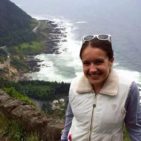
Coastal Oregon must consider the risks of earthquakes and tsunamis. However, moving development out of harm’s way is not possible when it is flanked by the ocean and steep, forested hills. This poses some major challenges for local officials looking for ways to make their communities more resilient. Meg Reed, a coastal hazard specialist with Oregon’s Coastal Management Program, is helping coastal cities and counties increase their resilience to tsunamis through land use planning programs.
Lessons Learned
- The land use planning process takes time. This public process aims to engage many people, which means it doesn’t happen quickly.
- Give people something to start with. By receiving a sample plan and development code language in the tsunami land use guidance, communities have something to build on.
- Maintain relationships with people in the community. It doesn’t have to be business all the time. Meg says that sometimes she stops in to a local partner office “just to say hi and see how folks are doing. That helps build rapport and trust.”
- A lot can be done with a little. For this project, three communities are each getting a small grant ($5,000), along with help from NOAA, to do the tsunami land use work. The communities can get a lot done with this small amount of money.
- Disasters can be motivators. When disasters happen, awareness and urgency are heightened, even if the disaster isn’t local. After the 2011 Japan tsunami, Oregon residents made planning for a major earthquake and tsunami a priority but needed resources to help them prepare in different ways. The Oregon Coastal Management Program used this opportunity to develop the Tsunami Land Use Guide, a tool to help municipalities modify their land use planning programs to be more resilient to tsunami risks.
- Letting folks know about hazards doesn’t have to be bad for business. Many coastal communities are destinations that rely heavily on a tourism economy. Messages can be framed positively, as in: “We care about our tourists. We want you to be safe when you are here.”
The Process
In Oregon, residents may not have much time to get to high ground before a tsunami arrives. That is why state and local government efforts are focusing on changing land use to make development safer during an earthquake and tsunami. Meg Reed, coastal hazards specialist at the Oregon Department of Land Conservation and Development’s Oregon Coastal Management Program says, “Our main focus is to get people out of harm’s way as quickly as possible. We are trying to balance how you make a community safer from tsunami hazards without changing a community’s character. Life safety is the first priority when working toward resilient communities.”
Oregon state law guides land use planning through statewide planning goals. Each city and county meets these standards through adoption of a comprehensive plan and zoning and land-division ordinances.
The state’s coastal management program saw communities struggling with their tsunami preparation. To help meet this need, they developed the Tsunami Land Use Guide. Meg is working with a number of local coastal governments to address this issue.
"It just made sense to develop a tool that helps local governments amend their land use plans and digest new hazard information about tsunamis,” Meg says. “This work is also a way to have communities assess their land both inside and outside of tsunami inundation areas for present and future uses and development."
Meg says this work is notable, as not many people are doing this type of planning. “We don’t have a model to follow; we are piecing together from experiences, other hazard planning processes, and examples from Japan on how to approach this risk.”
Communities are taking the sample code language from the land use guide and using it as a starting point to create development codes and identify where the focus needs to be in terms of resilience projects. “It helps people get over that initial barrier of where to start,” Meg points out.
Meg helps the communities customize the guide’s sample policies and codes to meet specific needs. Another big part of what she does is coordinating and administering the projects for each community, and finding and applying for grants to provide additional resources. “By doing the project coordination, it lifts the burden off the communities so they can focus on the issues and how to customize the approach to their community,” she says.
It is a partnership between the state agency and local governments to work toward tsunami resilience. Meg and other agency staff members provide digested hazard information, GIS and funding support, and sample land use codes, while the local governments lead the effort to update their land use planning documents through the public engagement process.
When asked how they approach communities to do this type of work, Meg attributes it to relationship building and maintenance. Meg says it has a lot to do with just showing up. Her predecessor, Laren Woolley, who retired last year, was well loved and respected by the local communities. Meg is following in his footsteps by building her own relationships with these communities.
“It’s about stopping by the office to chat. They see you are interested in their community. It builds trust,” she notes. “I think what also makes it easier for communities to use the Tsunami Land Use Guide is that many of their staff were on the development team and understand its benefits since they helped write the chapters.”
Digging into the Tsunami Guide
Communities use the guide’s sample land use policies and provisions related to tsunami risk reduction and recovery. They can use the language as is or modify it as needed. The guide contains a chapter that provides sample comprehensive plan policies and a chapter with development code provisions, including a model tsunami hazards overlay zone. Another chapter provides tsunami financing and incentive tools for implementing some of the tsunami evacuation improvements identified by the community. The guide also contains information resources for developing a tsunami-evacuation facilities improvement plan and preparations for post-disaster recovery.
Local-Level Application
“Getting to high ground is not always an option, depending on where you are and how bad an earthquake is,” Meg points out. “Therefore, vertical evacuation can be an important consideration in certain communities.”
The City of Newport, Oregon, saw this as an opportunity to increase its resilience in a vulnerable area, and used the guide to amend a building height restriction to allow for the construction of vertical evacuation structures. The city will also ensure that a newly proposed Oregon State University marine science building is constructed to withstand the worst-case scenario earthquake and tsunami event, serving as a vertical evacuation location open to the public.
Other communities are getting close to adopting amended land use plans that include tsunami provisions. Meg says, “Since this is a public process, it takes time. You want to ensure that people get a chance to review and provide input on this important issue.”
Outcome
Communities throughout Oregon are amending their current land use plans to incorporate tsunami resilience measures. The hope is that they will continue to look at how their land use plans and policies can reduce risk by locating essential development (such as schools, hospitals, and police stations) out of harm’s way and improving evacuation measures (such as hardening paths, providing lighting, and maintaining vegetation).
Next Steps
A new mapping effort called “Beat the Wave” shows how fast someone would have to travel to beat tsunami waves. This type of analysis will help municipalities pinpoint their most vulnerable areas and assets (e.g., a bridge that will fail during an earthquake and make river crossing impassable). They can then use this information to prioritize evacuation improvement projects to ensure that people know where to go and can get to safe ground in time. “Beat the Wave” provides a tailored evacuation analysis for each community’s specific geography and social context.
Contributors
- City of Cannon Beach, Oregon
- City of Coos Bay, Oregon
- Coos County, Oregon
- City of Florence, Oregon
- City of Newport, Oregon
- City of North Bend, Oregon
- Oregon Department of Geology and Mineral Industries
- Oregon Office of Emergency Management
- City of Reedsport, Oregon
- Tillamook County, Oregon
- City of Waldport, Oregon