Issue
Many remote coastal communities in Alaska currently have no formal storm history data, flood risk analysis, or way to predict and assess flooding impacts to their communities. These communities are at risk of flooding due to climate change and other coastal hazards such as storms.
Process
The National States Geographic Information Council’s member organization, the Alaska Division of Geological and Geophysical Surveys, applied for a Digital Coast Fellow to work on a project to define flood risk categories for several remote coastal communities in Alaska.
The fellow worked to gather available information on past flood events, estimated the height those floods reached using geospatial techniques, and determined the risk of coastal flooding that current infrastructure faces. He produced storm histories, an online tool for visualizing flood risks, and maps that rate the severity of local flood-risk zones and assess infrastructure risks.
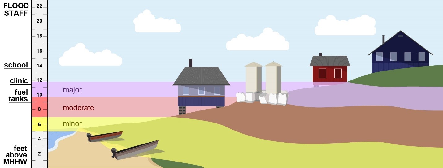
Impact
Two communities, Golovin and Hooper Bay, now have complete storm histories that help them better prepare for, and respond to, coastal storms. Weather forecasters are using the fellow’s maps to communicate flood risks in a way that’s easy to understand. And a publication will aid planners and hazard assessors in estimating the heights of local coastal flooding so they can refine their own risk analyses. The Division of Geological and Geophysical Surveys will use the publication to characterize flood risks for other at-risk communities.
Partners in the National Coastal Resilience Grant, impressed by this project’s success, awarded more than $1 million in funds to map flood risks and identify hazard data gaps for 44 additional Alaska Native communities. (2020)
Learn more about the Digital Coast Fellowship Program.