Challenge
Legislation required the state of Florida to assess flood vulnerability—identifying the infrastructure, critical assets, and communities at risk of flooding and sea level rise—for the entire state. It was a big task to compile and analyze all of the data needed to complete the assessment in the timeline they were given.
Solution
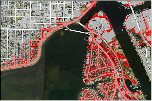
Using NOAA’s high-resolution land cover data of impervious areas, they were able to create an accurate statewide map showing the vulnerability to flooding of more than three million critical assets such as roads, rail networks, government buildings, critical infrastructure, and natural and cultural resources under current and future conditions. This information is helping the agency make crucial decisions on funding adaptation projects across the state.
By using the high-resolution C-CAP data, the team ensured their assessment reflects on-the-ground conditions and accounts for new urban development. Accurate, high-resolution data on impervious surfaces are crucial for coastal communities to assess changing flood risks and plan for a more resilient future.