Challenge
The Frying Pan Shoals area off Wilmington, North Carolina, is a potential source of sand harvesting; it is also considered an Essential Fish Habitat and an Aquatic Resource of National Importance. Before proceeding with leasing, the Bureau of Ocean Energy Management (BOEM) needed to assess the feasibility and environmental effects of dredging sand there.
Solution
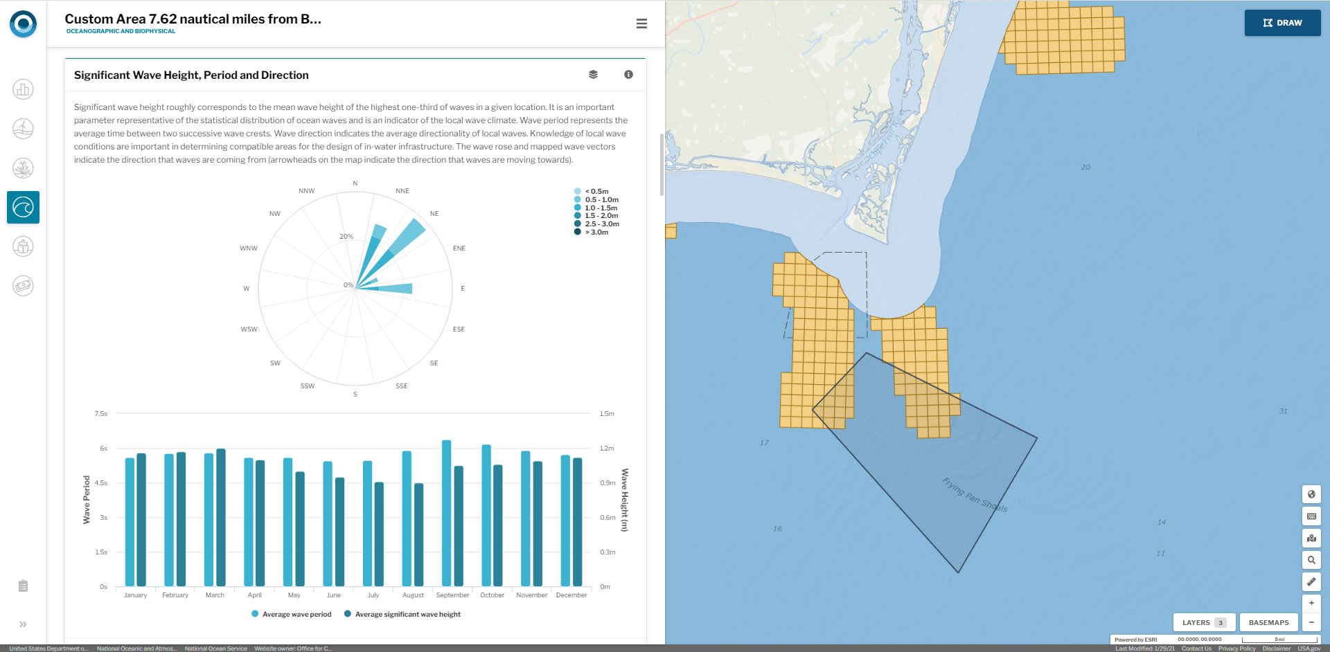
BOEM gathered scientific and academic experts in specific habitat types, dependent species, and ocean processes, and used the OceanReports tool to outline the study and highlight environmental information, sensitive habitats, other sand resources, and additional important information relevant to studying the Frying Pan Shoals area. The tool revealed potential use conflicts and allowed participants to view map results, provide their expert opinions related to impacts, and explore alternative locations in real time. This work helped BOEM publish a report, and is helping decision makers make informed sand-resource leasing decisions.