Challenge
The benefits of salt marshes are numerous—clean water, flood control, carbon storage, and fisheries habitat, to name a few. Understanding their location, changes, and future under sea level rise and coastal development is crucial for their protection. Detailed maps and models are necessary for this to happen.
Solution
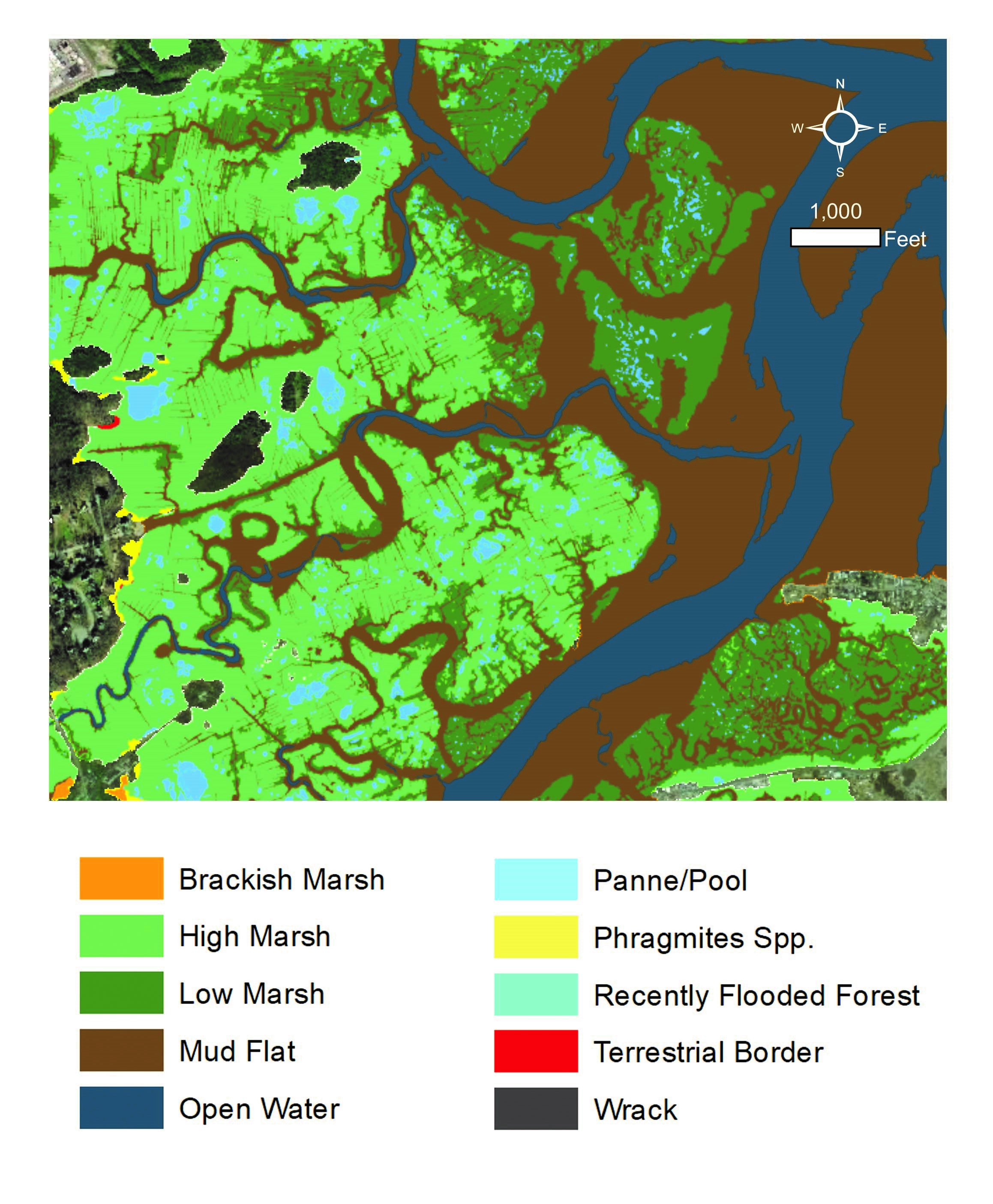
NOAA and the Great Bay National Estuarine Research Reserve, with the help of other partners, used high-resolution imagery, lidar, and field data to identify habitat types in a variety of marshes. They combined the habitat data with high-resolution land cover, shoreline, sea level rise, and other datasets, to conduct a statewide salt marsh resilience assessment.
The resilience assessment helped Great Bay Reserve and its partners identify marsh-specific management strategies and best practices for a statewide marsh plan. The plan acts as a screening tool to guide restoration, conservation, and planning efforts, establishing a baseline for future trend tracking and informing management plans. Its findings can also be used to secure resources and funding.