Issue
Pawleys Island, a small coastal town in South Carolina, sought to make the community more resilient and lower the expensive flood insurance premiums that coastal residents and business owners faced.
Process
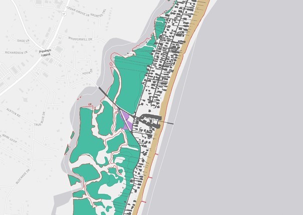
Using high-resolution land cover data from NOAA’s Digital Coast, the town mapped open spaces protected from development in the floodplain. This helped the town earn credits through FEMA’s Community Rating System, advancing it to the next program level. As a result, the community was able to successfully reduce flood insurance premiums, with Pawleys Island home and business owners now benefiting from a 25 percent discount.
Impact
By leveraging advanced technologies and data analysis, the town demonstrated the importance of proactive floodplain management. As climate change heightens the risk of natural disasters, it is crucial for towns and cities to adopt data-driven approaches to safeguard their residents and mitigate the impacts of extreme weather events. The commitment of Pawleys Island to floodplain management and open space preservation serves as an inspiring model for leveraging available resources to benefit the public. (2023)