Challenge
As Washington's Snohomish County sees a rapid increase in its population and development—making it one of the nation's quickest-growing counties—the changing and growing land use could have a negative impact on the health of the county’s waters.
Solution
To help monitor these waterways, Snohomish County created the State of Our Waters program, through which they collect biological, physical, and chemical data from rivers, lakes, and streams. This helps them understand the current health of these waters, track changes over time to pinpoint problems and their origins, and direct resources to protect healthy areas while working to improve those that are struggling.
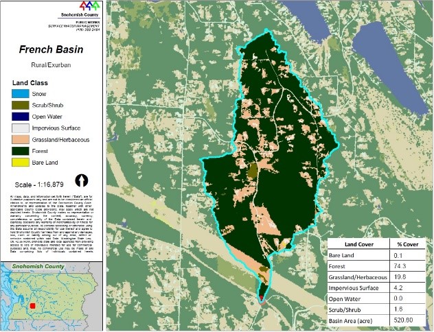
NOAA C-CAP high-resolution land cover data have been highly valuable for determining types of land cover along the waterways; differences in land cover characteristics help officials evaluate the influence of the county’s population growth and development changes. County officials then use this information to develop stream health reports. Since 2018, these reports have helped the county focus resources to protect healthy waters and improve impaired ones.