Overview
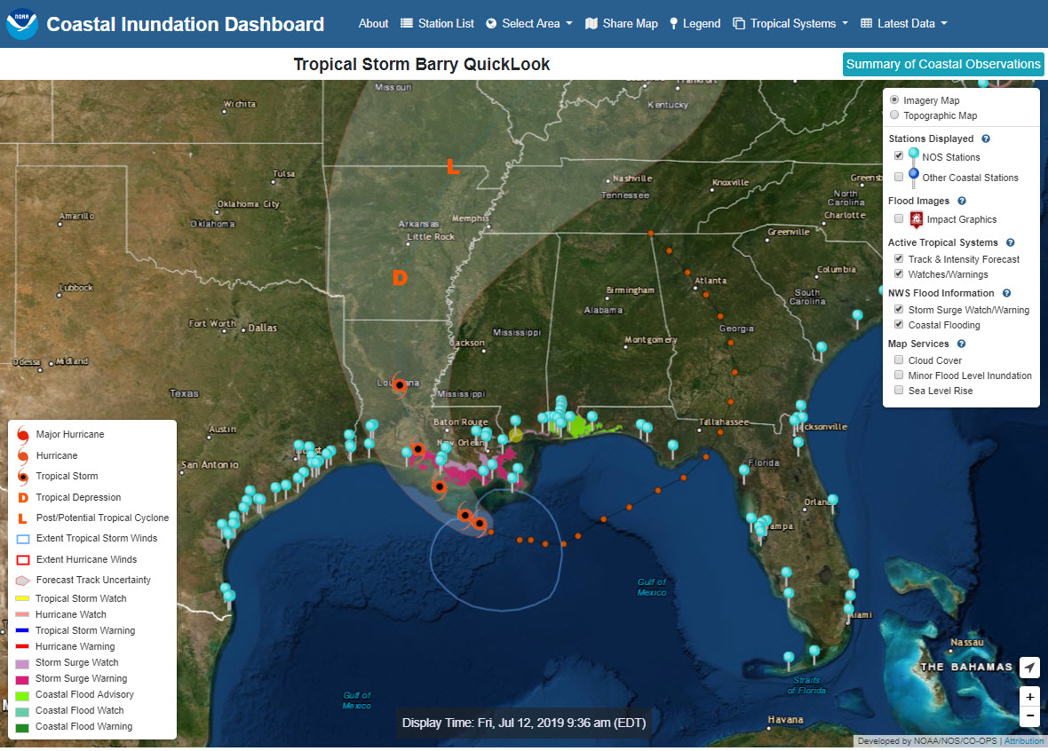
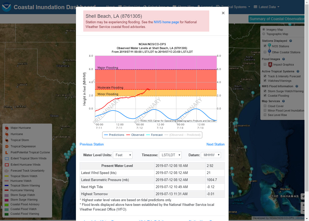
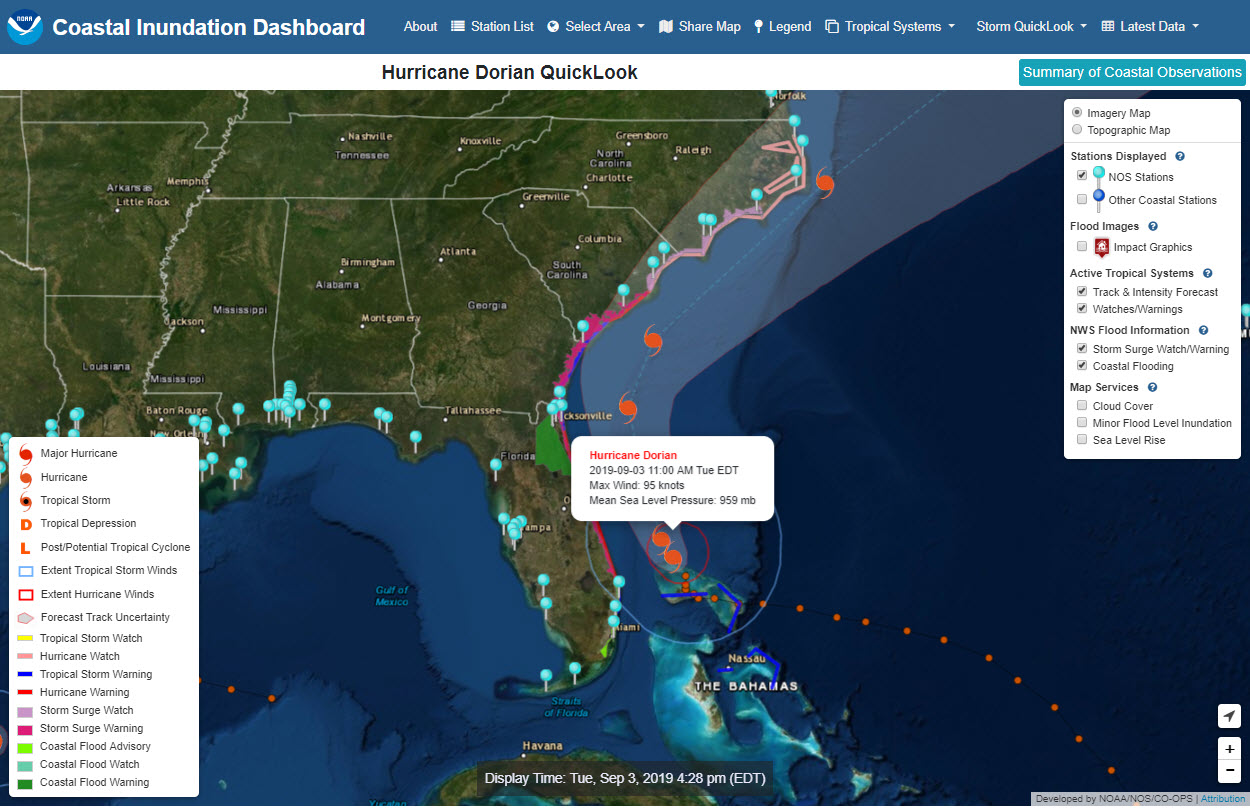
View real-time, forecasted, and historical water level information to understand near-term inundation risks, such as impacts from tropical cyclones or nor’easters, and longer-term risks, such as high tide flooding and sea level rise. This product uses NOAA’s National Weather Service flood impact thresholds to determine if observed or forecasted water level may result in minor, moderate, or major coastal flooding. Coastal decision makers can use this information to understand and prepare for the effects of coastal flooding and gain a better understanding of the increased frequency of flooding as sea levels change.
Features
- Access real-time water levels, 48-hour forecasts of water levels for select regions, and historical flooding information at a majority of the 200+ coastal water level stations
- Monitor water level conditions in the path of a hurricane, nor’easter, or other coastal storm in real time
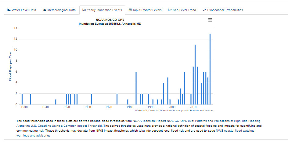
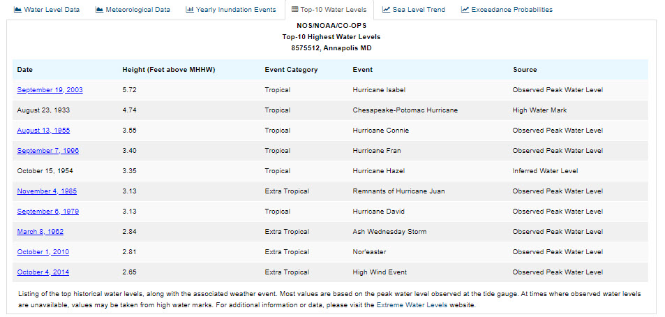
- Examine historical number of flood days per year and peak water levels for most stations
- View sea level trends and annual exceedance probabilities
Additional Information
Support
Tool Screenshots