Great Lakes Restoration Initiative
NOAA’s Office for Coastal Management has received more than $50 million since 2010 in Great Lakes Restoration Initiative (GLRI) funds to support projects and efforts with partners in the region.
The initiative was created by Congress in 2010 to provide funding and address the biggest threats to the largest system of fresh surface water in the world. This EPA–led initiative includes 16 federal agencies that work collaboratively or with nonfederal partners to implement protection and restoration projects. The GLRI Action Plan, which is updated every five years, identifies five major focus areas to serve as a guide for long-term restoration goals: 1) toxic substances and areas of concern, 2) invasive species, 3) nonpoint source pollution, 4) habitat and species, and 5) foundations for future restoration actions. NOAA’s Office for Coastal Management implements most projects under two of these focus areas: habitat and species and foundations for future restoration actions.
Project Snapshots
Supporting the Development of System Resilience Indicators for Wild Rice in Lake Superior, Lake Michigan, and Lake Huron
Building on the last two collaborative Great Lakes wild rice project phases (see story map and details below), this final phase takes a more holistic look at wild rice resilience in the Lake Superior, Lake Michigan, and Lake Huron basins. This phase includes additional geospatial and remote sensing technical support for Tribal-led monitoring and restoration efforts, more opportunities for convening and knowledge sharing, and help with identifying and addressing remaining data gaps. This project also focuses on contributing to the codevelopment of wild rice indicators to better understand the past, present, and future dynamics and stressors impacting distribution and resilience.
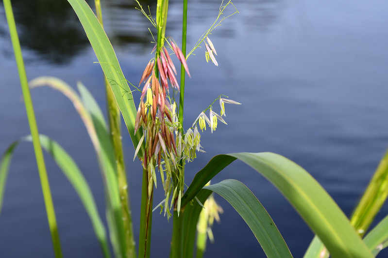
This project will be carried out in partnership with Great Lakes Tribes and First Nations, as well as the Great Lakes Indian Fish and Wildlife Commission, 1854 Treaty Authority, Lake Superior National Estuarine Research Reserve, academia, and tribal, federal, and state agencies. NOAA’s Office for Coastal Management will also work closely with Tribal partners to ensure free, prior, and informed consent and adherence to the CARE Principles for Indigenous data sovereignty and governance throughout all related efforts.
Supporting Community- and State-Driven Nearshore Habitat Restoration
Along many Great Lakes shorelines, climate hazard impacts, shoreline alterations, and infrastructure development have caused a loss of habitats and diminished cultural resources. Restoration of these shorelines requires an integrated systems approach to identify specific nearshore stewardship goals and place-based actions that will restore coastal biodiversity, cultural cohesion, and ecological and community resilience.
This project focuses on identifying and ranking potential habitat restoration projects. The top-ranked projects are then selected for engineering and design support. Two partnerships, listed below, are involved in this work.
Initiative for Resilient Great Lakes Coasts
This partnership between NOAA and the Great Lakes and St. Lawrence Cities Initiative builds the capacity of Great Lakes cities and communities to design and develop coastal projects that restore habitat while building resilience to hazards such as shoreline erosion, flooding, and increasingly frequent severe storm events.
The effort, which started in Lake Michigan in 2021 and has since expanded to include Lake Superior, St. Marys River, Lake Huron, St. Clair River, Lake St. Clair, and the Detroit River, brings scientific expertise, training, technical assistance, and engineering and design support to coastal communities. As of summer 2025, 12 engineering and design plans and one dune management plan have been completed, and support continues for an additional 12 projects. In the fall of 2025, the initiative will expand further to include Lake Erie, Lake Ontario, and Niagara River communities. Find additional details about the Initiative for Resilient Great Lakes Coasts, and learn how to participate.
Coastal States Organization Shoreline Assessment and Design Project
NOAA and the Coastal States Organization hosted workshops with state coastal programs and other interested parties in all eight Great Lakes coastal states to identify priority restoration projects. From there, engineering and design plans are developed for prioritized projects to bring them to 60–80 percent construction-ready status. There have been 12 engineering and design projects completed as of 2024. Find additional details about the Coastal States Organization’s restoration projects.
Collaborative Benthic Habitat Mapping in the Nearshore Waters of the Great Lakes
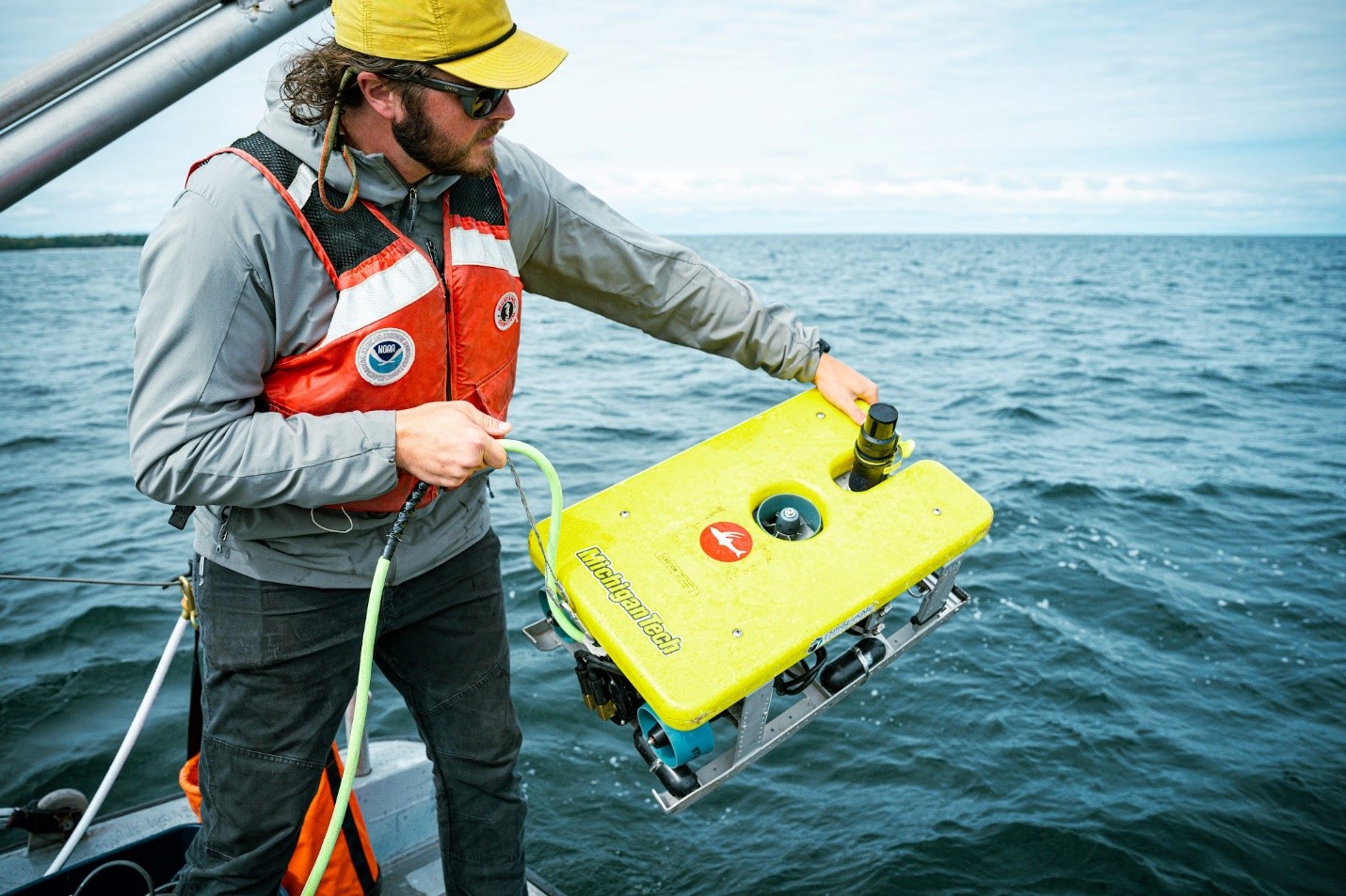
Contributing to the Great Lakes Restoration Initiative, the Collaborative Benthic Habitat Mapping project aims to fill critical gaps in bathymetry data through the collection of new airborne lidar and multibeam sonar data in the nearshore waters of the U.S. Great Lakes (0–80 meters). Project partners are also developing high-density benthic habitat characterization maps utilizing the Coastal and Marine Ecological Classification Standard to classify geoform, substrate, and biotic components. This work will aid habitat restoration and other critical management applications. Partners in this collaborative multiyear, multiagency effort include NOAA’s Office for Coastal Management along with the Office for Coast Survey, Office of National Marine Sanctuaries, National Center for Coastal and Ocean Science, Great Lakes Environmental Research Laboratory, and other federal and state agencies.
Bathymetry lidar products are publicly available through the Data Access Viewer on NOAA’s Digital Coast. Multibeam sonar products are made available through NOAA’s National Centers for Environmental Information (NCEI). Benthic habitat data and derived mapping products will also be available through NOAA’s Benthic Data Hub site, which is currently in development and anticipated for public release in 2025. The current status of high-resolution bathymetric data acquisition and validation and benthic habitat mapping for this project is available on this dashboard. This project also helps to support the Lakebed 2030 effort.
Other Project Examples
- C-CAP High-Resolution Land Cover: Producing one-meter resolution land cover data and developing wetland classification maps
- Coastal Wetland Framework: Developing a model to map coastal wetland extent and composition over time
- Illinois Beach State Park Monitoring: Multiphase monitoring effort to support coastal resource protection planning
- Hardened Shorelines Classification: Classifying segments of the U.S. Great Lakes shoreline as hardened or natural
- Understanding Wetland Ecosystem Benefits and Variability: Developed data and resources to understand the ecosystem benefits that wetlands provide by reducing the impacts of flooding within the Marengo Watershed of Wisconsin
- Wisconsin Point Dune Restoration: Completed designs and environmental compliance reviews for restoration and public access improvements
Additional Information
Quick Links
Impact Stories
Tools and Regional Data Sets
Resources
- A Guide to Assessing Green Infrastructure Costs and Benefits for Flood Reduction
- Collaborative Great Lakes Manoomin Project Story Map
- Ecological Limits of Hydrologic Alteration for Land and Water Management
- Economic Assessment of Green Infrastructure
- Great Lakes Economic Profile
- Great Lakes Partnership Case Study on Resilience Planning
- Great Lakes Resilience Planning Guide
- Lake Superior Manoomin Cultural and Ecosystem Characterization Study
- Land Cover Change Report for the Lake Michigan Basin
- OCM’s Great Lakes Services Footprint
- Technical Reports on Needs Assessments for Resilience Planning
Questions?
Contact coastal.info@noaa.gov