National Oceanic Atmospheric Administration Skip to main content

Take Action

Coastal flooding may hamper a community’s stormwater management today or in the not-too-distant future.

Take action to extend the service life of your stormwater management system and increase long-term resilience!

Where Do I Start?

Planning is a good first step because the goals and outcomes that will emerge can set the stage for the other action areas. But in reality, you can explore the following actions in any order.

Before beginning, consider the following:
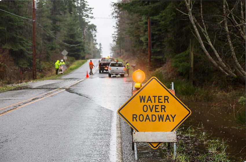
Timing
×
  • How soon do you need to act?
  • How long will particular actions be effective in reducing flooding impacts?
  • Are they short-term fixes or long-term solutions?
  • What is the expected service life of new or retrofitted assets?
  • What must be done in the near term to implement future actions?
  • At what point should you reassess and potentially modify your strategy?
Spatial Scale
×
  • How widespread are the impacts of current and future flooding across the stormwater system?
    • A few isolated areas or pockets?
    • Particular neighborhoods?
    • Across the entire community or regional watershed?
  • Will the size or distribution of these impacts change over time?
  • Which approaches work for the size and scope of the community’s particular problems today, and into the future?
Risk Management Approach
×
  • What is the community’s tolerance for flooding?
  • How frequently and to what degree is the community willing to accept the adverse impacts of flooding?
  • What strategy or combination of strategies reflect that risk tolerance?
  • Is the goal to prevent any coastal flooding (the “hold back the sea” approach), live with some, or allow all and adapt land use, engineering design, and human behavior accordingly?
Adaptive Management
×
  • Successful strategies include the capacity to change as on-the-ground conditions change or new information becomes available.
  • Which approaches provide adaptive capacity—that is, allow you to change your approach in response to new conditions?
  • Are there ways to collect information or implement solutions incrementally, as part of the day-to-day operation and maintenance of community property?
  • Are there short-term measures that have a cumulative impact over the long term?
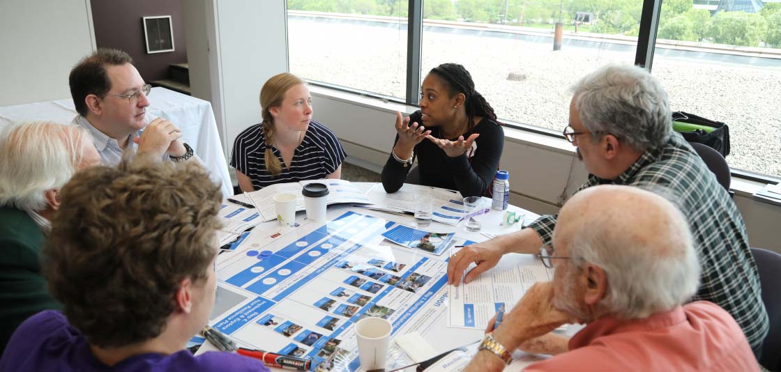
Community Support
×
  • Do stakeholders understand today’s flooding problems and those expected in the future?
  • Do they understand the benefits of proactive measures, and the costs of inaction?
  • Do stakeholders, including private-sector representatives, have early and frequent opportunities to help identify and vet alternative approaches?
  • Are there recent floods in adjacent communities or other events that can help overcome inertia or resistance to action?

Planning

Policy and regulatory requirements often lead communities to address stormwater flooding independently from riverine and coastal flooding. And engineering data, models, and mapping for each flooding source are often developed independently, further reinforcing this divide. Developing total water levels in the Analyze Stormwater Systems section will help provide an overview of the problem, but communities still have to work to integrate flood-related plans and management actions. Below are several types of community plans that can benefit from the application of total water level data.


Comprehensive Plan (or Master Plan or Land-Use Plan)
×

One of the most impactful plans a community can develop, comprehensive plans express a community’s vision for the future. While stormwater and other flood hazard overlays are typically incorporated as inputs, the results frequently show different flooding vulnerabilities for a site. Consolidating the data into a single overlay makes it easier to view the community’s flooding vulnerability more holistically and show the potential impacts of various land-use and infrastructure decisions.

Information on how combined flood hazards will change over time should also inform what measures the community considers in its alternatives. Some approaches may mitigate impacts over the short term but lose their efficacy as flooding severity or frequency increases over time. Communities should use the comprehensive planning process to explore when and where managed retreat from the shoreline may be the best approach for managing risk long-term.

Capital Improvement Plan
×

More implementation-oriented than comprehensive plans, capital improvement plans identify specific projects and associated budgets and time frames. Total water levels should be considered in any flood hazard and vulnerability assessment underpinning the capital planning process, particularly for siting and design of transportation assets co-located with stormwater infrastructure. If the capital plan relies on hazard information or alternatives from other plans or strategies, community planners may need to re-examine those alternatives against total water levels developed in "Analyze Stormwater Systems". Pinellas County, Florida has issued guidance on how to incorporate sea level rise with storm-related flooding into capital planning.

Transportation Plan
×

State and community transportation personnel routinely address stormwater and other flooding issues, but often lack data that reflect combined hazards. Transportation plans are a prime opportunity to introduce new infrastructure siting and designs that enable future adaptive management of co-located transportation and stormwater assets, such as culverts and drains.

Hazard Mitigation Plan
×

Developed to support state- and community-level efforts to identify and reduce natural hazard risks over the long term, these plans vary in terms of stormwater inclusion and detail. If only coastal and riverine flooding were addressed, communities would benefit from bringing stormwater program personnel and total water level information to the table when hazard mitigation plans are updated. Pinellas County’s Local Mitigation Strategy examines both coastal and stormwater flooding.

Stormwater or Watershed Management Plan
×

Many communities, particularly large municipalities, develop plans focused on stormwater management to meet regulatory requirements to enhance water quality and manage water quantity. The EPA has a detailed handbook on how to develop and implement watershed plans to meet water quality standards and protect water resources. EPA’s draft guide, Community Solutions for Stormwater Management: A Guide for Voluntary Long-Term Planning, helps states and local governments to develop and implement effective long-term stormwater plans. Communities participating in FEMA’s National Flood Insurance Program and its Community Rating System can earn credits towards flood insurance discounts by developing plans that meet criteria outlined in Activity 450, Watershed Management Master Plan.

Most, if not all, existing stormwater and watershed management plans lack information on the potential impacts of coastal flooding on the efficacy of stormwater systems over the near and long terms. Total water levels developed in "Analyze Stormwater Systems" can fill this gap and provide a common understanding of a community’s total flood risk. These data benefit not only stormwater or watershed plans, but also other community plans that leverage their findings or actions, such as capital improvement plans.

Floodplain Management Plan
×

Communities can earn credit under FEMA’s Community Rating System Activity 510 (Floodplain Management Planning) by following a 10-step process and generating a floodplain management plan that contains an overall strategy of programs, projects, and measures that will reduce the adverse impacts of flooding on the community and help meet other community needs. Rather than the traditional focus on only the riverine and coastal flood hazards shown on FEMA flood maps, total water levels (both present and future conditions) could form the basis of the plan’s risk assessment. Elements from Regulations, Standards and Guidance and On-the-Ground Measures could be incorporated into the community’s action plan.

Recovery or Redevelopment Plan (Pre- or Post-Disaster)
×

Recovery from a flood or other major disaster often provides communities with an opportunity to address challenges in their stormwater infrastructure and overall flood risk management. FEMA and the American Planning Association developed guidance for recovery or redevelopment planning for both pre-disaster or post-disaster situations. In these planning efforts, communities should consider the potential for increased runoff water volume, flow rates, and coastal inundation when reconstructing roads, pipes, and other infrastructure. While Hillsborough County’s Post-Disaster Redevelopment Plan doesn’t explicitly consider integrated stormwater and coastal flooding (total water levels), it does consider sea level rise and storms.

Community Area Development Plan
×

This type of plan identifies issues and options for development (or redevelopment) of a portion of a community—neighborhood, district, or corridor—towards a specific goal, such as waterfront revitalization. Current and future adverse impacts of combined stormwater and coastal flooding should be considered as neighborhoods or commercial districts are targeted for redevelopment.

Climate Adaptation Plan or Sea Level Rise Plan
×

Many states and communities have developed plans that identify their vulnerability to sea level rise, more intense storms, and other dimensions of climate change, as well as actions they can take to mitigate or adapt. While some plans address the impacts of sea level rise (with or without coastal storm-related flooding) on stormwater infrastructure, few effectively integrate coastal inundation projections with stormwater modeling, either for present conditions or for future scenarios.

Sustainability Plan
×

Communities may develop sustainability plans to meet goals focused on environmental or financial sustainability. As part of its Green Keys! Initiative, Monroe County, Florida developed a sustainability action plan that identifies the county’s vulnerabilities to sea level rise and climate change, followed by 165 recommendations and a project plan to make the county more sustainable and resilient.

-->

Regulations, Standards, and Guidance

Communities must navigate a complex framework of federal, state, and local policies and regulations to manage flooding. The examples in the planning section show the significant challenges communities face in overcoming stovepipes that can develop when complying with various mandates. The same is true for communities that manage stormwater and water quality issues separately from other sources of flooding. While knowing total water levels may not eliminate a community’s need to maintain distinct sets of regulations and standards, these data can help identify processes that may be working at cross-purposes and should be revisited.

National Pollutant Discharge Elimination System (NPDES)
×

The NPDES stormwater program regulates some stormwater discharges from three potential sources: municipal separate storm sewer systems (MS4s), construction activities, and industrial activities. Operators of these sources might be required to obtain an NPDES permit before they can discharge stormwater. This permitting mechanism is designed to prevent stormwater runoff from washing harmful pollutants into local surface waters. Operators of regulated MS4s develop stormwater management programs that describe the stormwater control practices they will implement consistent with permit requirements to minimize the discharge of pollutants. To aid their compliance with the NPDES program, communities typically adopt and enforce a stormwater ordinance that establishes minimum requirements, design standards, and procedures. Some smaller communities not subject to NPDES also voluntarily adopt and enforce such ordinances. The impacts of coastal inundation are rarely considered in the stormwater modeling or infrastructure design that underpin state and local NPDES programs or stormwater management ordinances. To better prepare for potential impacts, a good practice could include reviewing all pertinent state and local regulations and design standards, and considering revising to account for changes in precipitation (frequency or intensity) and the timing, duration, and severity of coastal inundation, including sea level rise. Revised requirements could include implementing more conservative performance criteria, such as higher design flood elevations and volumes that consider combined rainfall and coastal flooding (See On-the-Ground Measures). These criteria could be applied to both stormwater infrastructure, such as pipes, storm drains, catch basins, and best management practices, including green infrastructure and low impact development codes and techniques.

Coastal Nonpoint Pollution Control Program
×

As a condition of federal funding, states and territories with approved coastal zone management programs are required to develop comprehensive coastal nonpoint source pollution management programs that are backed by enforceable authorities. NOAA and the EPA jointly developed overarching management measures for five major source categories of nonpoint pollution (agricultural runoff, forestry runoff, urban runoff, marinas and recreational boating, and hydromodification), and for wetlands, riparian areas, and vegetated treatment systems. State and territorial coastal programs work with peer agencies across these sectors, such as forestry, agriculture, environment, health, and transportation, and local governments to develop the coastal nonpoint program and implement management measures.

Coastal nonpoint programs are typically tightly integrated with the state’s NPDES program, with some programs providing detailed guidance (for example, Georgia’s Coastal Stormwater Supplement) that builds upon NPDES program requirements and adds specific considerations for coastal resources and physical processes, such as sea level rise. Many of the planning efforts, regulations, standards, and best management practices that fulfill NPDES requirements also help states and territories meet the management measures specified in their coastal nonpoint program. States and territories may benefit from using information on total water levels and how they may change over time to assess the adequacy of management measures in meeting their water quality objectives.

Flood Damage Prevention Ordinance
×

Communities adopt and enforce flood ordinances as a condition of participating in FEMA’s National Flood Insurance Program. At a minimum, communities must regulate development in the 100-year floodplain as designated on FEMA flood maps. While these maps consider flooding from rivers and coastal water bodies, they typically do not reflect stormwater hazards, nor do they consider future flooding caused by sea level rise or other climate impacts.

Some communities have successfully integrated FEMA floodplain management requirements with their stormwater regulations. The City of Ocala, Florida developed maps that combine FEMA inland flood zones and stormwater hazards, which form the basis of their flood ordinance. Similarly, Pinellas County, Florida’s flood ordinance applies to flood zones shown on FEMA’s maps (inland and coastal hazards) and flood-prone areas mapped in its local stormwater management plan and drainage basin study.

Whether implemented independently or integrated with stormwater management, communities should review the effectiveness of their existing floodplain regulations, codes, and standards in light of the potential future impacts of total water levels. They should answer questions such as these:

  1. Does any community-wide freeboard need be increased to account for combined flood hazards and future conditions (both rainfall runoff and sea level rise)?
  2. Are design flood elevations or flow volumes for new or repaired infrastructure adequate to prevent damage or loss of service due to the combined flooding expected over its expected service life?
Building Codes and Standards
×

The 2015 International Building Code, 2015 International Residential Code, and many state building codes require freeboard as established in the ASCE 24-14 Flood Resistant Design and Construction standard. These minimum freeboard values may not be adequate to account for combined flood hazards and future conditions.

Transportation Design and Construction Standards
×
Flooded road with hazard warning sign and first responders assisting stranded car.

State and local transportation departments rely on specifications such as those published by the American Association of State Highway and Transportation Officials (AASHTO). The Federal Highway Administration and AASHTO are developing new guidance on how to account for climate impacts, including changes in precipitation frequency and intensity, changes in coastal storm characteristics, and sea level change, on hydrologic and hydraulic design of transportation infrastructure.

Other Infrastructure Design and Construction Standards
×

State or locally derived standards may include considerations for allowable runoff, which may need updating to reflect future conditions for both the rainfall and coastal contributions to total water levels.

Green Infrastructure Codes and Standards
×

This framework from Wisconsin Sea Grant Wisconsin Sea Grant is designed to help communities plan and implement green infrastructure for stormwater management through municipal codes and ordinances.

Zoning
×

Modifying allowable development types, densities, and building heights in areas currently or projected to be vulnerable to combined stormwater and coastal flooding can be highly effective in reducing future impacts on stormwater system components and other community assets.

On-the-Ground Measures

Effectively managing stormwater requires a well-designed system that is regularly monitored and maintained. More frequent or severe coastal flooding can adversely affect structural system components (including both “gray” and “green” infrastructure elements) and their operation in many ways. The methods in the Analyze Stormwater Systems section can be used to reveal where a community is vulnerable. Communities can use that information to plan and implement a wide array of measures on the ground so their systems provide the desired levels of service.

Holding Back the Sea
×

Communities have a range of measures to help them protect existing stormwater infrastructure from coastal flooding and damage caused by flood-related wave action, erosion, sedimentation, or saltwater exposure. These measures range from large-scale civil engineering works designed to protect entire communities or large parcels, to small-scale, site-specific features intended to protect specific assets or functions:

  • Tidal or surge barriers are physical floodgates constructed in the water at inlets, rivers, or other narrow breaks in the coastline that, when closed, can prevent high tides or storm surges from traveling inland.
  • Sand dunes, wetlands, and other natural or nature-based infrastructure are physical barriers that can protect communities or specific properties from floodwaters or attenuate high-velocity flow and wave action. To learn more about green infrastructure and how it can be used to build flood resilience, check out some of NOAA’s Digital Coast resources (particularly the training, quick reference, and effectiveness database), resources from the EPA, and the U.S. Army Corps of Engineers' Engineering with Nature program.
    Wetlands at Murals Inlet, South Carolina
  • Levees, seawalls, revetments, and other floodwalls are designed to block floodwaters from inundating communities, individual properties, or specific buildings or machinery, such as pump stations. Among the considerations for use of these barriers are the design flood levels, which should consider combined total water levels over its service life, and impacts on adjacent coastal properties, public beaches, and other natural resources.
  • Dry flood-proofing can prevent water from entering specific nonresidential buildings or specific machinery through the use of sealed exterior walls, watertight doors, and water-resistant materials. The risks of coastal floods that exceed the design flood elevation must be considered carefully along with the need for evacuation of personnel.
  • Backflow prevention devices, such as gates, tidal flap valves, and duckbills, can prevent saltwater intrusion and tidal backflow from penetrating stormwater pumps and pipes.
Living with the Sea
×

Other measures allow for intermittent or temporary inundation of system components without inflicting damage or hindering performance. One such approach is wet flood-proofing, where buildings or machinery are designed to allow floodwaters to passively enter and exit. For example, while traditional suction lift and dry well pumps will typically fail when flooded, submersible pump stations are designed to operate underwater and thus can provide communities with critical operational capacity and greater resilience to flooding. As with dry flood-proofing, communities contemplating wet flood-proofing approaches for their stormwater facilities should consider the impacts of coastal flooding that exceeds the design flood elevation or expected flood duration.

Depending on projected coastal total water levels and the rate that they may increase over time, these measures may only delay the inevitable—the frequency or severity of flooding may become so great that none of the measures here or in “Holding Back the Sea” remain effective. The time frame over which these measures are expected to be effective is a critical dimension of planning, particularly given the potential costs and long lead times for capital improvements. Once those approaches are no longer viable, managed retreat from the shoreline and relocation of assets become important options for your overall strategy.

Reducing or Slowing Rainfall Runoff
×

Measures for decreasing the volume or flow rate of rainfall range from landscape scale—such as open space preservation, urban forestry, or park and other public land management—to site-specific practices, such as BMPs. Which approach, or combination of approaches, your community needs will depend on the geographic scope and severity of your current and future stormwater management challenges. While the balance of this section focuses on site-specific measures, the links above provide some representative resources for larger-scale efforts.

Many of the BMPs and low-impact development approaches that communities use to improve water quality, including measures required under their NPDES permit, may help reduce the volume or flow rate of runoff delivered to and moving through the stormwater system, particularly for smaller rainstorms, such as 1- or 2-year events. Examples include grass swales, vegetated filter strips, wet ponds, dry ponds, green roofs, permeable pavements, and subsurface detention reservoirs. Learn more about these approaches:

Communities considering these measures should be aware that coastal inundation from storms and sea level rise, as well as rising groundwater tables, may adversely affect their short-term or long-term efficacy. For example, higher groundwater tables may diminish the performance of infiltration features or subsurface reservoirs, while vegetation used in wet ponds or restored wetlands may need to be changed to better tolerate exposure to salt via wind or water.

Moving Stormwater More Efficiently
×

Communities have options for increasing the capacity of their stormwater systems to collect and convey runoff and deliver it to the final receiving body — the tidal river, bay, or ocean. Such options include

  • Installing larger pipes and appropriately upsizing culverts to convey anticipated higher rainfall runoff volumes
  • Maintaining drainage ditches (in rural areas) and pipes (in urban settings) to convey anticipated higher rainfall runoff volumes
  • Raising stormwater system inlets to increase gravity flow from outlets
  • Installing pumps to force water out when tidal flooding inhibits gravity-based discharges from outlets
  • Adding additional conveyance and treatment capacity to account for future capacity decreases and service interruptions due to flood events
  • Installing more detention and retention ponds to control release of runoff to receiving water body

Funding

Identifying and obtaining sustained funding to support key actions may prove to be the most challenging aspect of mitigating the impacts of coastal flooding on stormwater management. Consider these approaches as you tackle the funding issue.


Baby Steps
×

On-the-ground measures that protect against higher coastal flood levels or that increase stormwater system capacity at the community scale can come with high costs, requiring time and political will to implement. Phased implementation, outlined in capital improvement or stormwater management plans, may allow smaller, short-term actions to come online and provide immediate risk-reduction benefits while you pursue funding for larger, long-term solutions. Ocean City, Maryland, opportunistically upgraded culverts and channels whenever stormwater structures came up for regular replacement. A clear strategy, tying together short- and long-term actions and demonstrating their benefits, is key to getting buy-in from stakeholders.

Take the Long View
×

Large capital expenditures, such as engineered flood protection structures and pump stations, are long-term community investments. To ensure that these investments stand the test of time, identify and secure funding sources for necessary maintenance and adaptive actions as coastal water levels rise and stormwater volumes change.

Think Outside the Grant Funding Box
×

Demand for traditional federal and state grants far outstrips available resources, a trend expected to continue into the foreseeable future. Communities should start exploring nontraditional streams of dedicated funding, such as

  • Tax Increment Financing (TIF) ×

    TIF is a mechanism for capturing the increased property tax revenue generated through capital improvements within a specific area. Chicago, Illinois, has successfully used it to fund public infrastructure and development projects. The city has leveraged its public investment to attract over $6 billion in private capital investment over two decades of development. Similarly, Iowa has a robust TIF program, with a component focused on flood mitigation.

  • Environmental Impact Bond (EIB) ×

    EIBs are modeled on social impact bonds, an innovative finance mechanism that seeks to mobilize private capital investors to supplement public investment dollars. In the social impact bond model, the private sector works with governments and philanthropies to fund critical, prevention-focused social programs that help address issues like prison recidivism, homelessness, and early childhood education. In this public-private partnership, investors are only repaid if and when improved social outcomes are achieved. In September 2016, DC Water issued a $25 million EIB to finance the construction of green infrastructure to manage stormwater runoff. It is a 30-year tax-exempt municipal bond with a mandatory tender in year five.

  • Stormwater Management Utility Fee ×

    Stormwater management utility fees allow communities to generate revenue based on the impact of a developed property on stormwater management. Prince William County, Virginia, assesses a stormwater management utility fee to all owners of developed property. Orlando, Florida funds its stormwater management through a stormwater utility fee, which receives broad community support by linking the fee to community flooding and water quality concerns.

Don’t Go It Alone
×

As much as engaging the private sector (both for-profit enterprise and nonprofit organizations) is critical in planning, pursuing regulation or standards changes, and implementing on-the-ground measures, it’s even more important in generating the political will necessary to support new funding streams.

Effectively demonstrating the benefit that major capital investments can provide to the community can also prompt development of public-private partnerships that bring private capital to the table. These partnerships are formal collaborations between governments and the private sector in which small amounts of public funding are used to attract private capital. As of December 2015, 33 states have passed some form of public-private partnership enabling legislation to encourage private-sector investment in infrastructure (wastewater, transportation, stormwater, and green infrastructure). The EPA provides more information on community-based public-private partnerships.

Private nonprofit groups, land trusts, and other nongovernmental organizations can provide or find funding that turns proposed actions into reality. They can help retain and acquire critical lands, such as wetlands and other habitats, for restoration or preservation in a natural state. Groups such as the Land Trust Alliance and its more than 1,000 member land trusts have partnered successfully across the nonprofit, government, and business sectors.

Don’t Put All Your Eggs in One Basket
×

The breadth of actions necessary to mitigate the impacts of coastal flooding on stormwater management will most likely exceed the scope of a single funding source. You may need to develop a “menu of options” that leverages multiple funding streams to support planning, construction, monitoring, maintenance, and adaptation.

For example, the Greater New Orleans Urban Water Plan provides a roadmap for improving management of stormwater, flood, and subsidence threats, while creating economic value and enhancing quality of life. Stormwater, surface water, and groundwater must be managed together as resources for enhancing public spaces, revitalizing neighborhoods, strengthening habitats, and providing opportunities for economic growth. The plan emphasizes the importance of creative financing that blends common investment tools with policy change and diverse funding sources, and focuses on social and environmental benefits to expand funding options. Funding come from these sources:

  • Grants and awards from various government entities
  • Innovative funding mechanisms such as public-private partnerships
  • Regulatory structures
  • Fees, credits, and incentives
  • Other means to stimulate private investment in public projects
Funding Resources and Tools
×

These federal, state, and local sources and strategies may provide support as you pursue actions to build the resilience of your stormwater management system to coastal flooding.

  • The EPA’s Water Finance Clearinghouse contains available funding sources for stormwater infrastructure and the second contains resources, such as reports, weblinks, webinars etc. on financing mechanisms and approaches that can help communities access capital to meet their water infrastructure needs. The EPA also provides an exhaustive list of Green Infrastructure Funding Opportunities, which includes tools that help communities explore funding options for stormwater projects.
  • The Georgetown Climate Center’s Green Infrastructure Toolkit has a section dedicated to funding and financing green infrastructure, which could be leveraged to support broader stormwater management objectives.
  • The U.S. Climate Resilience Toolkit provides links to adaptation funding sources.

Case Studies: Bringing It All Together

Every day, more and more communities across the country are taking steps to better understand and address stormwater challenges triggered by coastal flooding. The following case studies stand out for their innovation and multi-faceted approaches, particularly concerning their conceptualization, design, and implementation of on-the-ground measures.

Massachusetts Coastal Zone Management – Climate Impacts on Best Management Practices

Using an analysis of sea level rise and climate-related increases in storm frequency and intensity, the case study identifies approaches to improve the selection, siting, design, construction, and operation and maintenance of stormwater BMPs to ensure their adaptability and continued performance.

City of Wilmington, North Carolina – Community Resilience Pilot

A sea level rise vulnerability assessment informed 54 adaptation strategies to protect the city’s water and wastewater infrastructure, ranging from engineered approaches for asset protection to land use, planning, regulations, and incentives.

City of Olympia, Washington – Engineered Response to Sea Level Rise

Combined stormwater and coastal total water level data guided development of near-term and long-term actions to manage site-specific stormwater issues and protect the city’s downtown from combined flooding.