National Oceanic Atmospheric Administration Skip to main content

Understanding Stormwater Inundation

Coastal storms and related surge-related flood events are happening more frequently, as is tidally influenced flooding. Heavy rain also seems to be playing a bigger role. This section provides background information about the different types of coastal flooding and the potential impacts on stormwater management.

What Contributes to Coastal Flooding?

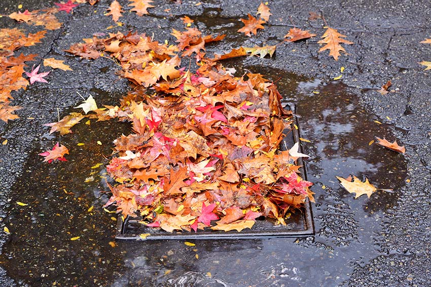
Total water levels that generate flooding in a coastal community are not limited to the coastal events described in the next section. Precipitation events that trigger flooding in rivers and streams across a watershed or that cause localized, urban flooding can combine with coastal events. The resulting total water levels often translate into more widespread or prolonged flooding than the community would have experienced from each flooding source alone.

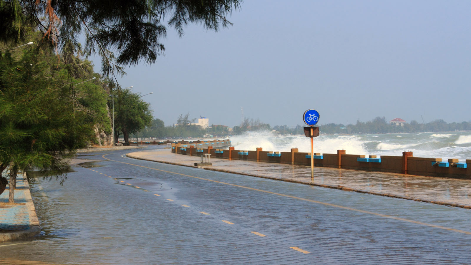
Coastal total water levels at an ocean or large lake shoreline can be defined as the combination of tidal variation, regional oceanographic effects (such as the El Niño-Southern Oscillation), storm surge (including wave setup), local wave action, and long-term sea level rise or lake level change. Water levels related to seiches or tsunamis could be included with these elements where they are key contributors to coastal flooding, but these sources are not evaluated as a part of this website.

Highest Tide / King Tide
Wind Waves
Regional Oceanographic
Sea Level Rise

Regional Oceanographic

×

Highest Tide / King Tide

×

King Tide with Rainfall

×

Wind Waves

×

Storm Surge

Sea Level Rise

Add Sea Level Rise to view impacts.

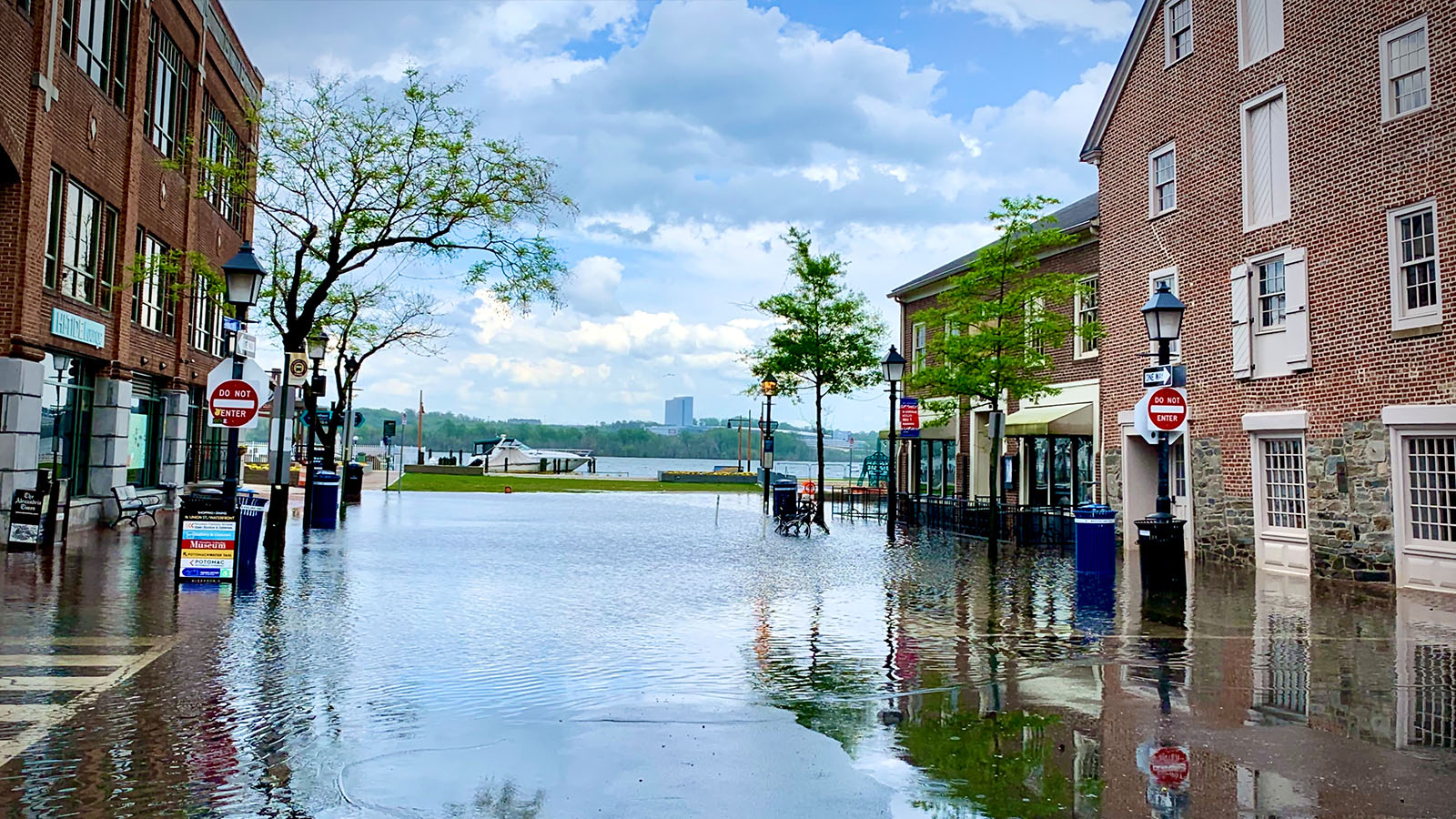
Location plays a large role in the proportional influence of each coastal element, especially during extreme water level events. Variations in astronomical tides can be a principal factor in Alaska, whereas in other places storm surge (Galveston, Texas) and wave runup (San Francisco, California) primarily drive high water levels.

Expected future conditions will play a significant role in coastal flooding. Long-term water level changes from sea level rise will affect the extent, frequency, and duration of coastal flooding events. High-tide flooding events that occur only a few times a year now may occur once a month, or once a week. These same water level changes may also increase groundwater levels, which could impact the ability to naturally capture and store rainfall runoff. Changing precipitation regimes in many coastal areas are expected to result in more intense rainfall rates during storms, which may increase the frequency of both rainfall runoff and river flooding. Increased frequencies of these types of flooding events occurring independently increases the chances of these events occurring at the same time.

Flooding Types

To understand the impact of coastal flooding on stormwater management, you must be aware of the types of flooding that coastal communities experience. There are three primary causes: rainfall runoff, river flooding, and coastal flooding.

  • Rainfall Runoff occurs from a precipitation event, and a heavy event (defined by high rainfall rates) can overwhelm a stormwater management system, causing water to inundate roads and property.
  • River flooding primarily results from an extended precipitation event that occurs at, or upstream from, the affected area. River flooding can also occur when traditional flood-control structures, such as levees and dikes, are overtopped. Significant river flooding events in many coastal areas are often the result of tropical cyclones, such as Hurricane Floyd (1999) or Hurricane Harvey (2017).
  • Coastal flooding occurs in areas directly adjacent to coastal waters. There are several distinct causes:
    • High-tide flooding occurs in low-lying coastal areas during extreme high tides (also known as perigean or king tides ). These tides occur a few times per year when the sun, moon, and earth align. By definition, a coastal storm is not necessary for high-tide flooding to occur. However, even relatively weak onshore winds can increase the level of flooding.
    • Storm surge results from more severe storms such as tropical cyclones (hurricanes and typhoons) and nor’easters, as strong winds drive water onshore. For example, Hurricane Hugo (1989), Hurricane Katrina (2005), and the March 2018 nor’easter generated extensive storm surge. Communities do not have to be directly in or next to the path of a large storm to experience surge effects. Wave setup, an increase in water levels caused by breaking waves offshore (while the storm is approaching the coast), increases the height of storm surges.
    • Seiches are a surge-related coastal flooding phenomenon experienced on large lakes, such as the Great Lakes. During a seiche, water pushed up against one coast from a storm surge event moves to the opposite end of the lake. This results in both abnormally high and low water levels on opposite sides of the lake in a short period of time.
    • Localized wave action can significantly increase the amount of storm-related flooding and associated damage. Many factors contribute to wave heights , including wind speed and direction, nearshore bathymetry, and land cover near the shoreline. Wave runup is a significant hazard along steeply sloping shorelines and bluffs. Wave overtopping is the flow of water over the crest of a coastal structure, such as a seawall or dike, due to wave action. In addition to the damage waves can inflict directly on buildings and infrastructure, wave action can erode the shoreline and adjacent uplands.
    • Tsunamis are large waves generated by an abrupt disturbance of the sea surface, such as from an earthquake or landslide. A tsunami caused by a local event arrives minutes after generation, while a tsunami caused by a distant event arrives hours later. The 2011 Tohoku tsunami along the Japanese coast is a recent example of the devastating effects of tsunamis.

In addition to episodic flooding events, coastal communities are experiencing long-term water level changes caused by global sea level rise, relative sea level rise, and the Great Lakes’ water level cycles.

  • Global (or eustatic) sea level rise is caused by a change in the volume of the world’s oceans due to expansion as the oceans warm, as well as the melting of land-based ice (glaciers and ice sheets).
  • Relative sea level rise is caused by a combination of global, regional, and local sea level increases caused by regional oceanographic patterns, such as the Atlantic Multidecadal Oscillation, El Niño-Southern Oscillation, hydrologic cycles (river flow), and local or regional vertical land motion (subsidence or uplift).
  • Long-term Great Lakes water level cycles cause periods of higher and lower lake levels that correspond to longer-term temperature and precipitation trends. Record low levels, such as those seen in Lakes Michigan and Huron in 1964, can impact navigation. Higher water levels, like those that occurred in 2017 in Lake Ontario and are now occurring (as of 2018) on Lake Superior, can contribute to property damage from coastal storms.

Impacts: Stormwater Infrastructure

  • A coastal town flooded by storm

Coastal communities employ a variety of engineered systems to manage stormwater.

Regardless of the system, the low-lying nature of many coastal areas presents unique stormwater management challenges that are exacerbated by coastal flooding.

Smaller coastal communities often employ a simple system of surface conveyances, such as open ditches along roads and highways. Some larger communities have separate systems for stormwater and sewage. Older areas may have combined sewer systems that collect and treat both stormwater runoff and sewage, but many of these are being phased out because of water quality and overflow issues.

Regardless of the system, the low-lying nature of many coastal areas presents unique stormwater management challenges that are exacerbated by coastal flooding.

  • Some systems depend on gravity to help water move through the pipes. Flat topography can make this a difficult approach that is further compromised by flooding that causes outfalls to be partially or completely submerged. This combination can greatly prolong a flooding event.
  • Coastal flooding at outfalls may drive backflow into the system, causing upland flooding through street drains and drainage ditches. The prolonged presence of saltwater can damage stormwater infrastructure.
  • Shoreline erosion may expose stormwater infrastructure to potential damage.
  • Flooding may introduce debris that can clog storm drains, pipes, and outfalls.
    Storm drain covered by leaves in the early fall
  • More frequent, higher, and longer-lasting high water events may drive up already high groundwater levels in some coastal communities. This change may reduce the soil’s ability to absorb stormwater, thus increasing runoff.

Identifying thresholds beyond which the stability and performance of existing stormwater systems are adversely impacted is an important way to understand the current and future vulnerability to changing coastal total water levels. Understanding the necessary performance criteria for stormwater systems to handle current and future water levels should lead to determining critical thresholds for both the design and retrofitting of new and existing systems. Critical thresholds are where stormwater infrastructure, such as outfalls, becomes vulnerable. Duration of coastal flooding events is also an important factor. Longer duration events tend to impact infrastructure more negatively. Longer storm surge or high tides will impact stormwater pipes, drain inlets, and overland flow volume, therefore increasing the duration of the flood event.

Using the information generated from the Quick Flood Assessment Tool in the “Assess Flood Risks” section and the methods presented in the “Analyze Stormwater Systems” section, coastal communities can make informed decisions about the current and future capabilities of their stormwater management systems in the face of coastal flooding.

Impacts: Community

Beyond the basic impacts to life and property that flooding can impose on individuals, a stormwater management system impaired by coastal flooding events can have far-reaching effects on the community at large. Minor flood events can disrupt transportation, which affects everything from emergency access to the flow of goods and services, as well as the ability of people to get to and from their homes. Floodwaters that cannot infiltrate or drain may become stagnant, creating additional impacts on human health.

The ability of a community to handle such events is dependent on the frequency of occurrence. Excessive flooding over time, even minor events, can change how people live and how businesses and the community operate. This can cause detrimental economic impacts on real estate values and tourism, and other negative impacts to businesses.

A Call to Action

The impact of current and future coastal flooding on stormwater management is a community-level issue that demands a coordinated, integrated response from across the community. Stormwater managers and engineers play a key role in maintaining a level of service to protect life and property during precipitation events. However, as coastal flooding impacts the ability of a system to maintain that level of service , floodplain managers, land use planners, and public works personnel should be engaged to develop comprehensive strategies to address the issue in the short and long term. The sections below outline considerations for specific community functions and highlight opportunities to work more collaboratively. The “Take Action” section provides a range of options that can be employed to address the issue.

Considerations for Stormwater Management
×

New approaches are needed as traditional stormwater management infrastructure becomes impaired.

In the short term, stormwater levels can be reduced through the introduction of low impact development techniques. Engineered options, such as tide gates, for instance, can prevent backflows from surge events. But these options aren’t likely to last for the long term. More expensive and disruptive options, from extensive modifications of existing stormwater practices to the installation of pumps or engineered flood protection structures, may be necessary. In addition, a broader watershed-scale approach to managing stormwater can be employed by engaging land use planners and implementing land development policies and regulations that align community growth and development with stormwater management goals.

Considerations for Floodplain Management
×

Floodplain managers need to understand how flood hazards are changing and what this means for infrastructure, property, life safety, and environmental resources in their communities’ floodplains.

In most communities, the flood zones mapped by the Federal Emergency Management Agency (FEMA) form the basis of local floodplain management. Unfortunately, these maps do not reflect stormwater flooding and related infrastructure, nor do they reflect a robust understanding of coastal and precipitation-related flooding happening simultaneously, as can occur during hurricanes and other large coastal storms. That lack of integrated coastal and riverine flood modeling leaves communities with an incomplete picture of how one flooding source may affect the geographic extent or severity of the other.

Similar to the mapping disconnect, floodplain management and stormwater management may be disconnected at the local level if those programs are led by different agencies who must follow different federal, state, and local requirements. In the absence of integrated mapping and management, floodplain and stormwater managers and planners must work together to devise and implement solutions at both site-specific and watershed scales. These efforts should be responsive to the community’s overarching flood risk reduction goals, ordinance requirements, codes, or other legal mandates, as well as any other risk management actions that go above and beyond legal requirements (for example, activities credited under the National Flood Insurance Program’s Community Rating System ).

Considerations for Land Use Planning
×

Land use planners help determine where and how development occurs and coordinate with floodplain and stormwater managers, since land use decisions can affect flood hazards and the community’s risk management approaches. For example, sprawling, lower-density development often means more impervious surfaces and more runoff, increasing demand on stormwater infrastructure. Higher-density development, coupled with strategically planned networks of natural landscapes, can lower the amount of runoff and thus reduce dependence on built infrastructure to manage stormwater. In addition, plans that emphasize the protection and restoration of coastal wetland landscapes, which absorb excess water, can provide flood protection benefits.

Considerations for Public Works
×

Public works personnel are critical to the operation and maintenance of key components of the stormwater management system, such as storm drains, outfalls, and pump stations. They also support community preparation and flood response, such as monitoring and closing roads and assisting first responders in search and rescue operations. Public works personnel will be among those helping to construct and maintain transportation and stormwater system assets. They are in a good position to observe asset performance and identify repair or retrofit needs over time.

What’s Next?

“How high does the water need to get before we have a problem?”
“When do we think that will happen?”

“How high does the water need to get before we have a problem?” and “When do we think that will happen?” are two reasonable questions to ask. The next section will help you arrive at answers for your community by helping you derive coastal flooding thresholds for your community, determine how these thresholds will change over time, and use this information to assess the impact of total water levels for your community’s stormwater management system.

Go to Assess