Issue
Erosion is a serious problem for Lana‘i, one of the main Hawaiian islands, and this erosion can negatively impact fragile coral reefs. Understanding which areas are most prone to erosion—sediment source hot spots—and which coral reefs are at the greatest risk is essential information for prioritizing land restoration investments.
Process
The first step involved obtaining comprehensive land use and coastal land cover data to develop a landscape development intensity index. For Lana‘i, high-resolution data were available from NOAA’s Digital Coast. Elevation, land cover, precipitation, soils, and R-Factor (ersosivity) data were then entered into a Digital Coast tool, OpenNSPECT, to determine sediment and water runoff rates.
Impact
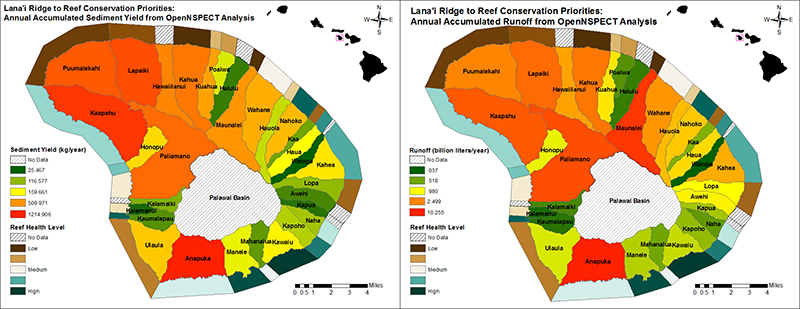
Landscape development intensity was determined for all Lana‘i watersheds, along with sediment and water runoff. By comparing these values, researchers were able to single out some watersheds as being the most prone to soil erosion and broad habitat deterioration. These results were compared to reef ecosystem-condition data available from the NOAA Coral Reef Program. The results were used to select watersheds for priority action, with the highest priority given to those impaired watersheds located next to the healthiest reefs. The next step—beyond the scope of this project—would be to use more sophisticated software packages, such as InVEST, along with additional Digital Coast tools and data sets, to better incorporate the financial aspects of various restoration scenarios and decisions.