Issue
Hurricane Charley slammed into the Gulf of America coast of Florida in 2004, making landfall along the southern end of North Captiva Island. The category 4 hurricane caused significant erosion and left a breach in the southern portion of the barrier island. While the breach healed naturally over time, researchers needed to study the migration of sediment along the island to better understand the shoreline evolution.
Process
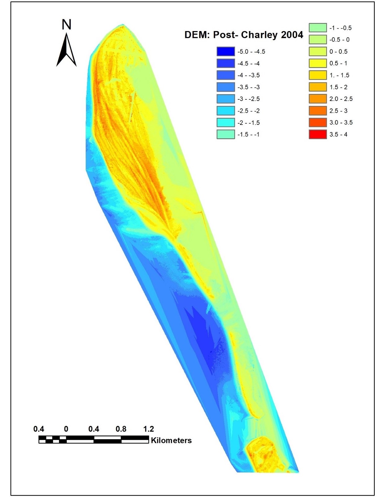
The research team used lidar downloaded from NOAA’s Data Access Viewer to develop digital elevation models to study the migration of sediment over time. The team used lidar from several years after the hurricane—2004, 2007, 2010, 2015, and 2018—to extract depth profiles using reference monuments installed along the Florida coast by the Florida Department of Environmental Protection. After graphing the depth profiles, the team had a better understanding of the depth changes over time and the process of sediment migration along North Captiva Island.
Impact
Through the results, the team discovered that the breach healed naturally over the course of three years. The results indicate that the sediment naturally transported from the north end of the island to the southern end, which sustained more erosion from Hurricane Charley. (2021)