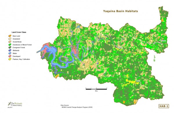
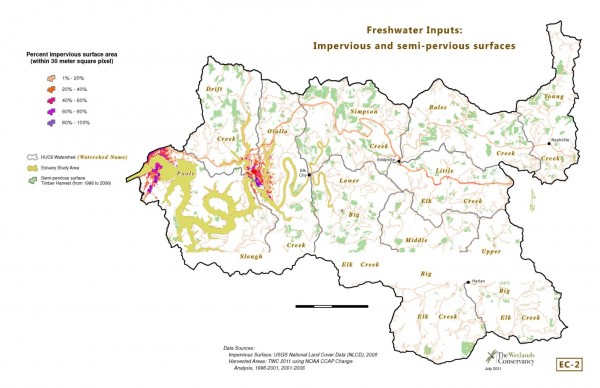
Issue
The Wetlands Conservancy developed a conservation plan for the Yaquina Estuary in Lincoln County, Oregon (2011). Part of the analysis required understanding sedimentation processes and watershed threats. Clear-cut timber harvests have long been identified as a potentially significant contributor to excess sediment loads in streams, and eventually, in estuaries. However, timber harvest records on private lands are not centralized or available in GIS format, making it difficult to quantify this potential threat.
Process
The Wetlands Conservancy used NOAA’s land cover data to detect timber harvest activities over five-year intervals (1996-2001 and 2001-2006). This selection of land cover change data, which was combined into a single coverage, gave an approximation of clear-cut timber harvest areas. A comparison with pre- and post-dated aerial imagery confirmed the utility of the approach.
Impact
The land cover data provided a quick and reasonably accurate representation of clear-cuts. This information was analyzed along with impervious surface data (from the U.S. Geological Survey’s National Land Cover Database). The information, included in the Yaquina Estuary Conservation Plan, is guiding conservation, restoration, and acquisition efforts.