Overview
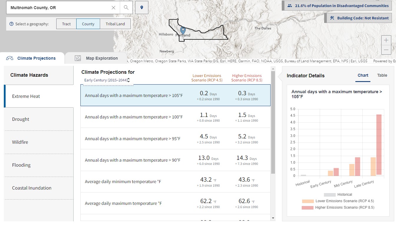
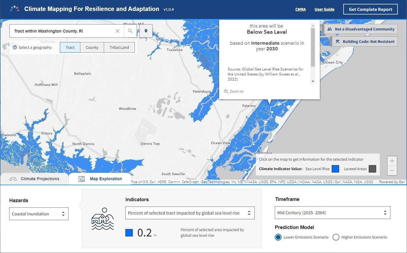
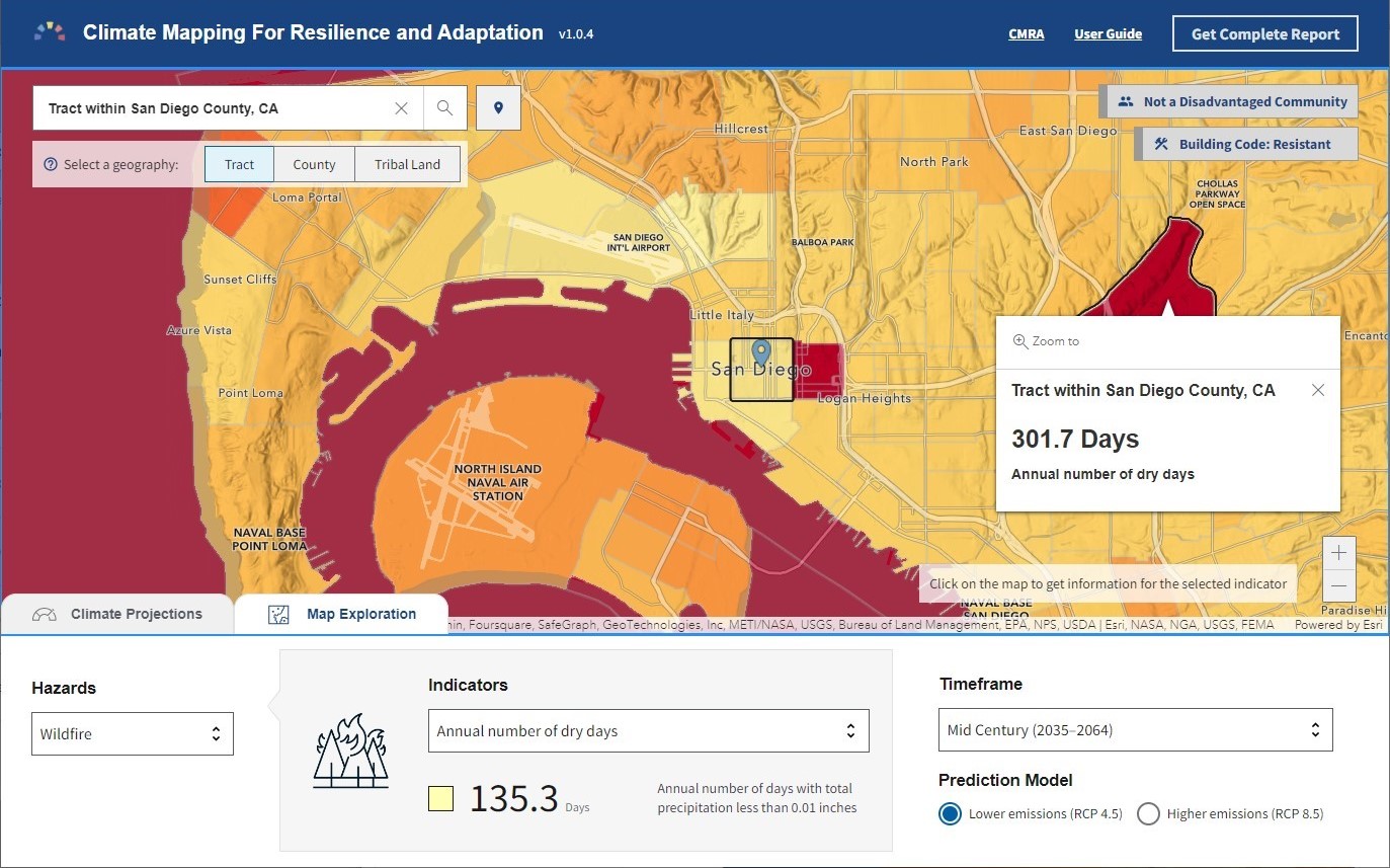
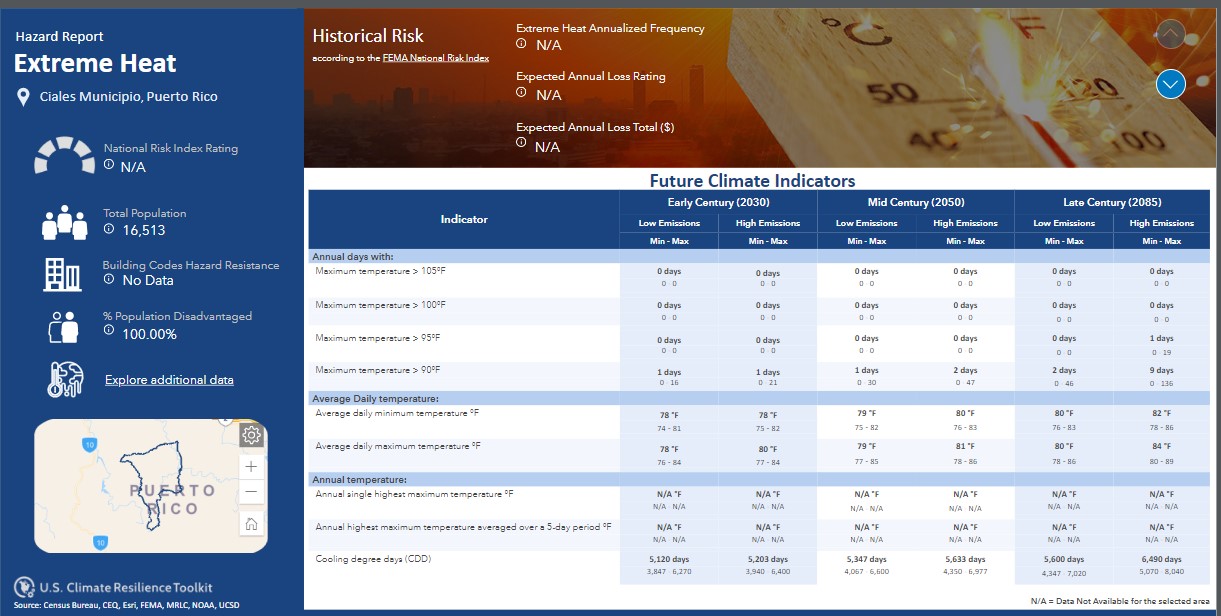
This tool provides an assessment of climate hazard information to assist federal agencies and recipients of federal funds in identifying, prioritizing, and implementing climate-informed infrastructure investments. Users can explore current and future exposure to five major climate-related hazards: extreme heat, drought, wildfire, flooding, and coastal inundation. The information provided can support the planning and implementation of climate-resilient projects down to the census tract level.
Climate Mapping for Resilience and Adaptation Homepage
Features
- Explore current and future exposure to five major climate-related hazards
- Access GIS-ready data organized by hazard
- Identify disadvantaged Census tracts or tribal lands (based on the Justice40 criteria)
- Create a hazard report for your current geography
Tool Screenshots