Overview
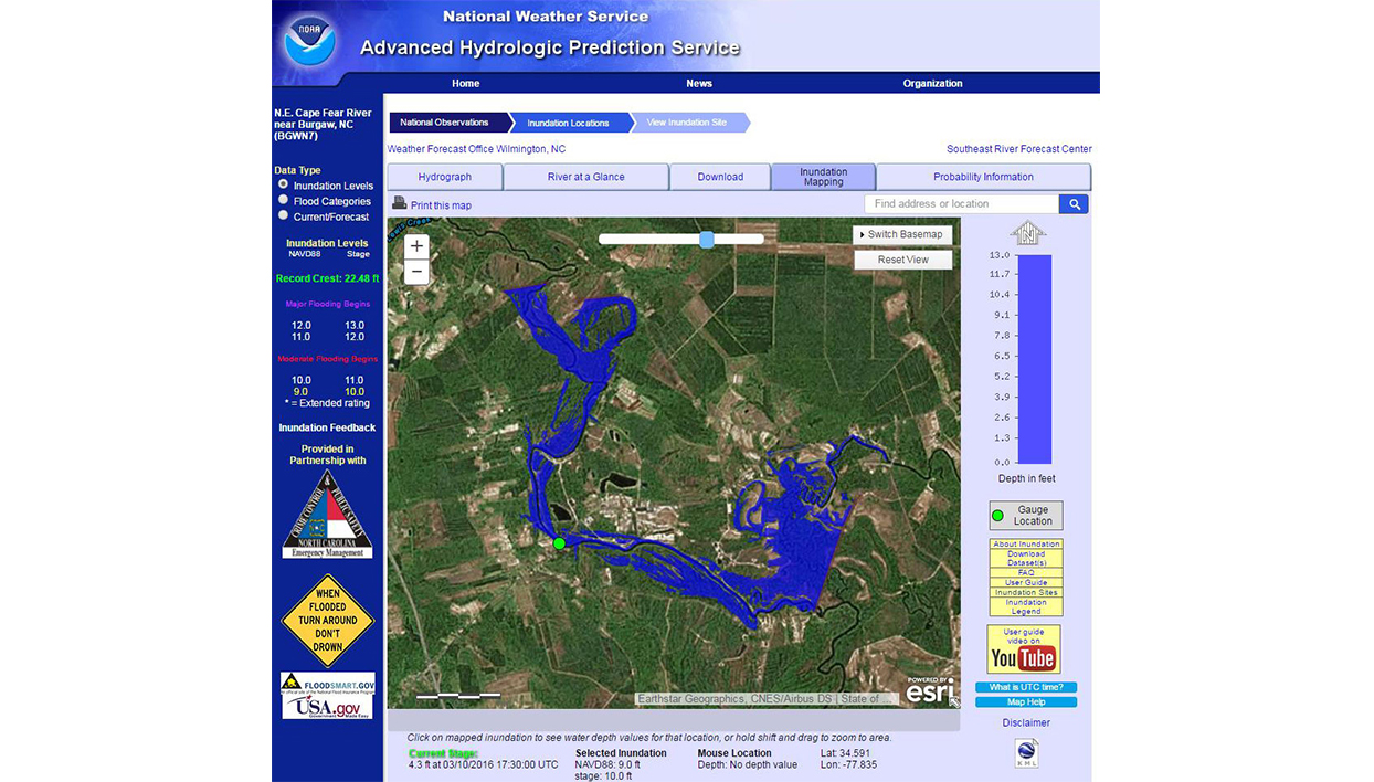
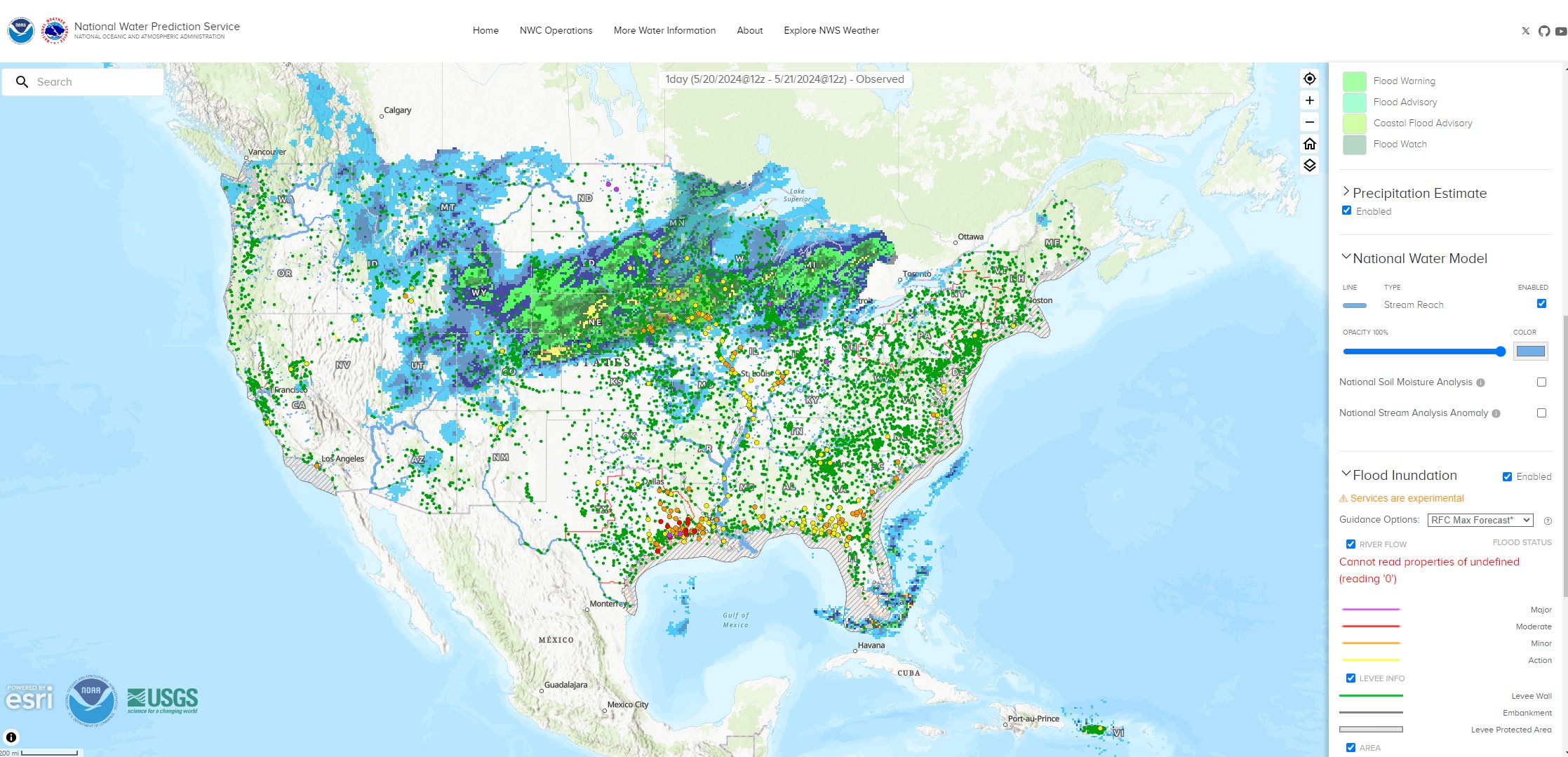
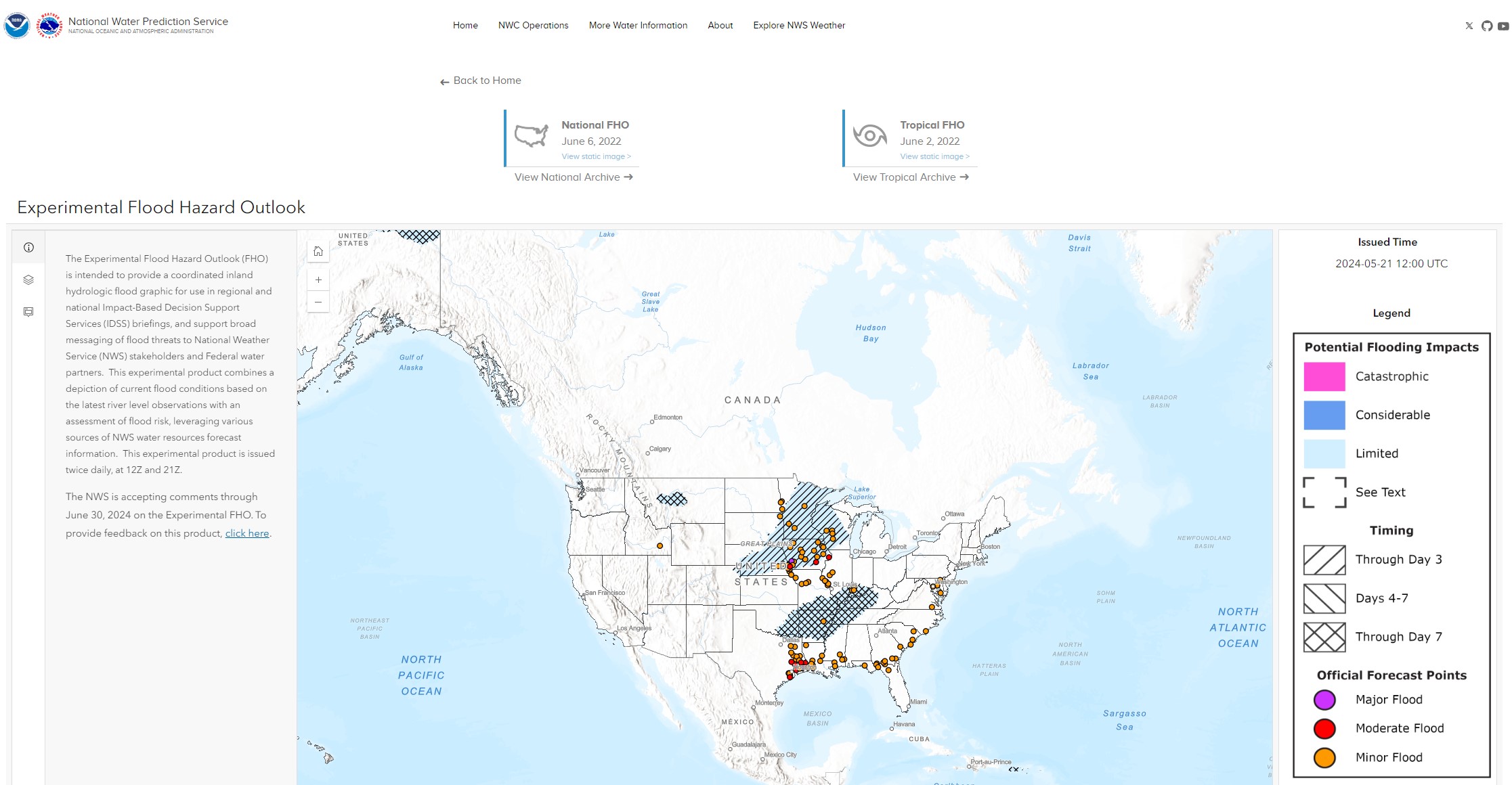
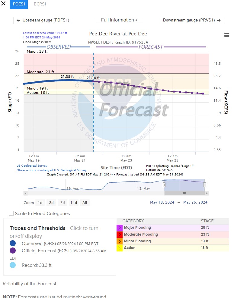
This tool is the one-stop shop for National Weather Service water resources information, including river observations, forecasts, accumulated precipitation maps, flood inundation maps, and data services. The online interactive maps help users visualize where inundation will affect their communities. When flood forecasts are released, officials can use these maps to scroll through the different river flood stages to see how inundation could impact local roads, infrastructure, and resources.
Features
- Access flood forecast, meteorological, and hydrological information
- View interactive flood maps, graphs, tables, and key products
Additional Information
Support
Tool Screenshots