Overview
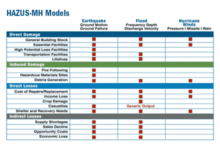
This nationally applicable, standardized method estimates potential losses from earthquakes, hurricane winds, and floods. State-of-the-art GIS software maps and displays hazard data and estimates of damage and economic losses to buildings and infrastructure.
Requires ArcGIS 10.x
Features
- Estimate physical damage to facilities and infrastructure
- Calculate economic loss, business interruptions, and repair or reconstruction costs
- Determine social impacts to floods, earthquakes, and hurricanes
Additional Information
Data Requirements
Support
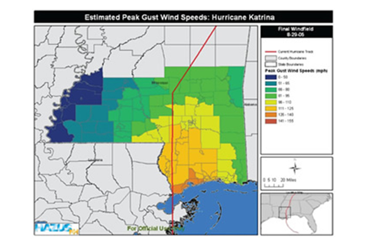
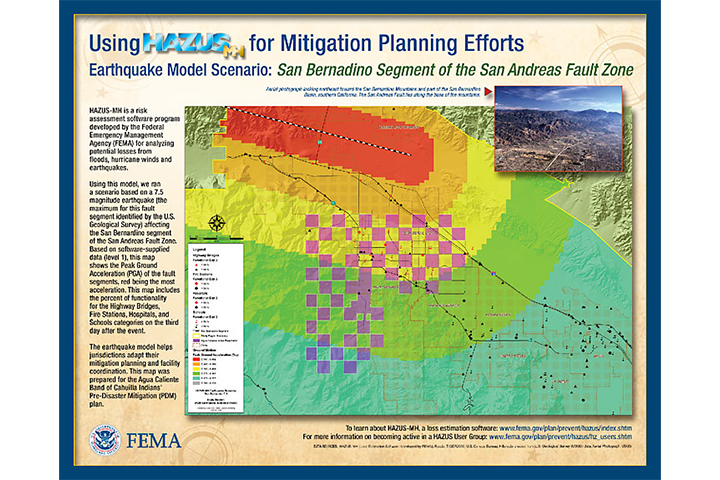
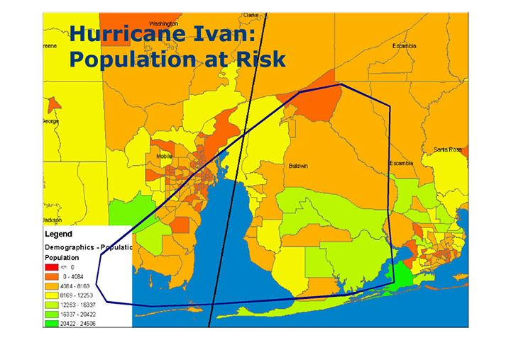
Tool Screenshots