Important: The Coastal County Snapshots datasets are no longer being updated. As a result, the reports do not reflect the most current conditions.
Overview
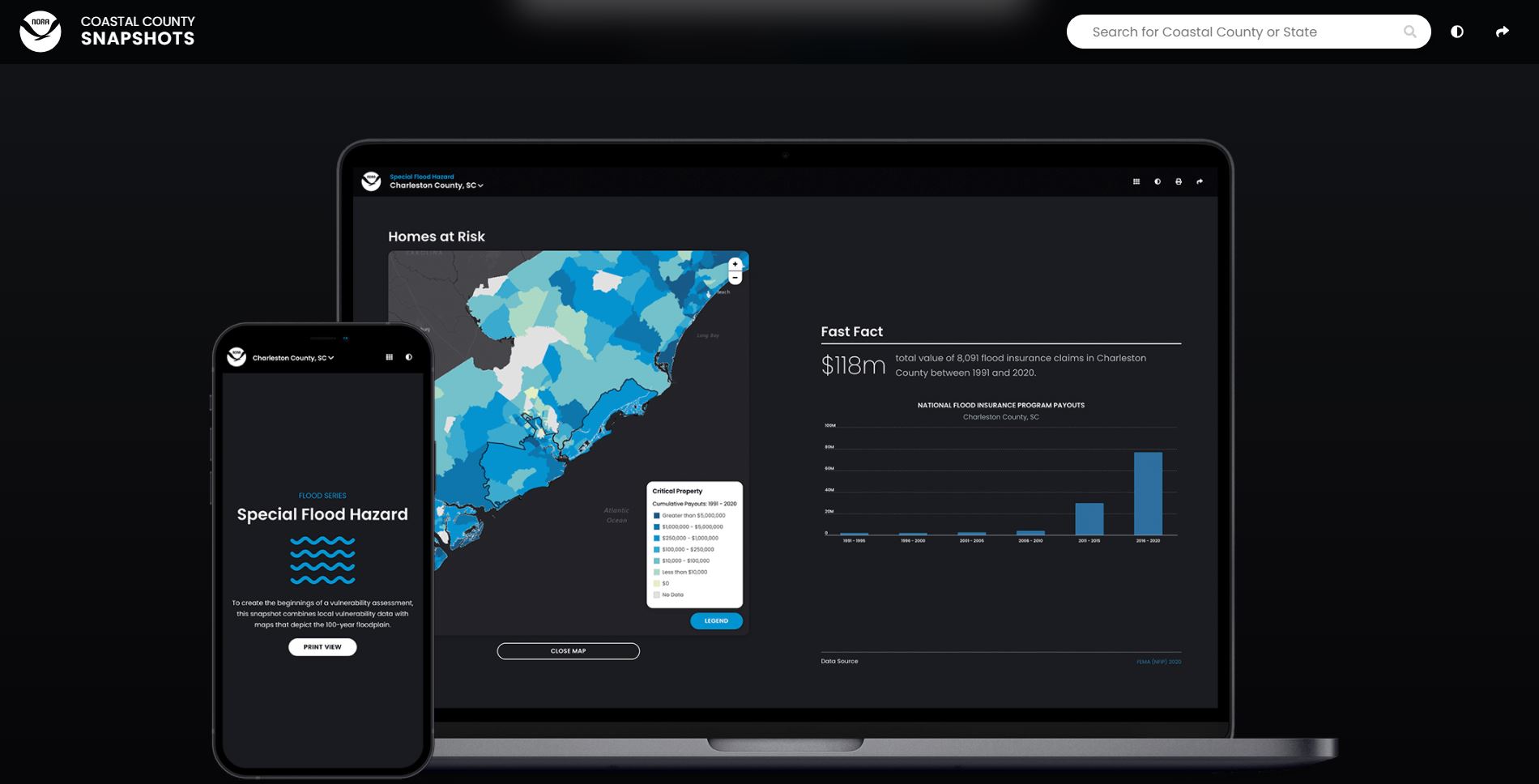
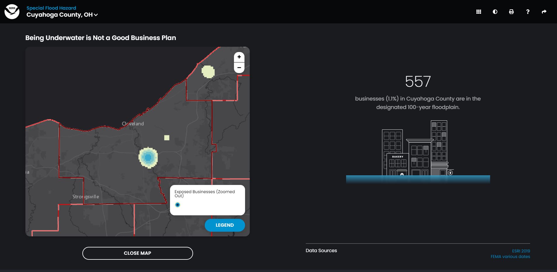
This online tool provides an easy way to better understand county resilience in terms of flood hazards, critical facilities, jobs, businesses, and more.
Users choose their county and topic of interest and the tool does the rest, automatically combining complex datasets to create county-specific insights. The resulting charts and graphics are easy to understand and are used to show community leaders and the public where the county is most vulnerable.
Print and electronic options are available. The print version is useful as a handout and for general awareness. The electronic version allows users to see the data superimposed on a map or through a graphic interface, and provides access to the data used to make each snapshot.
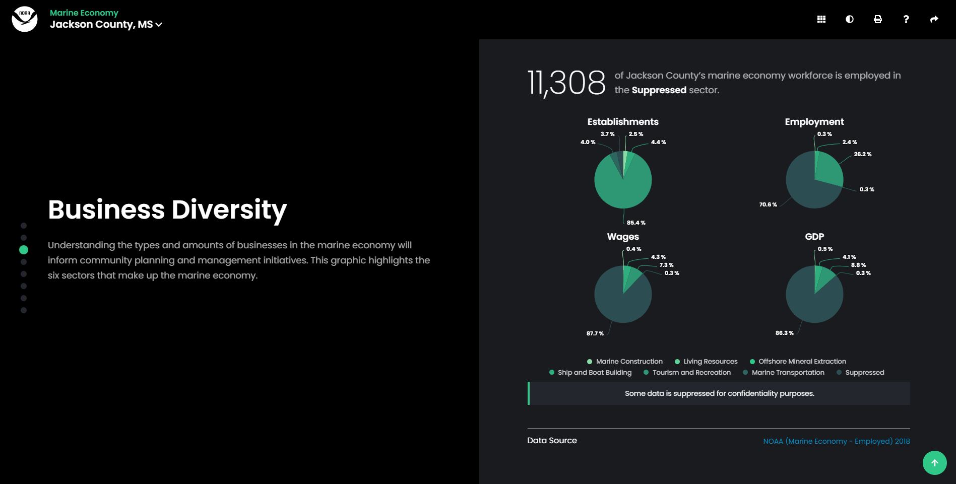
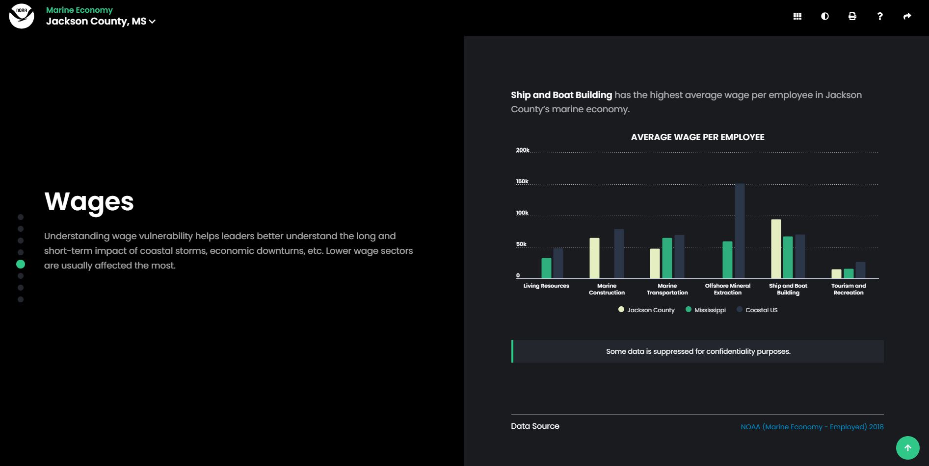
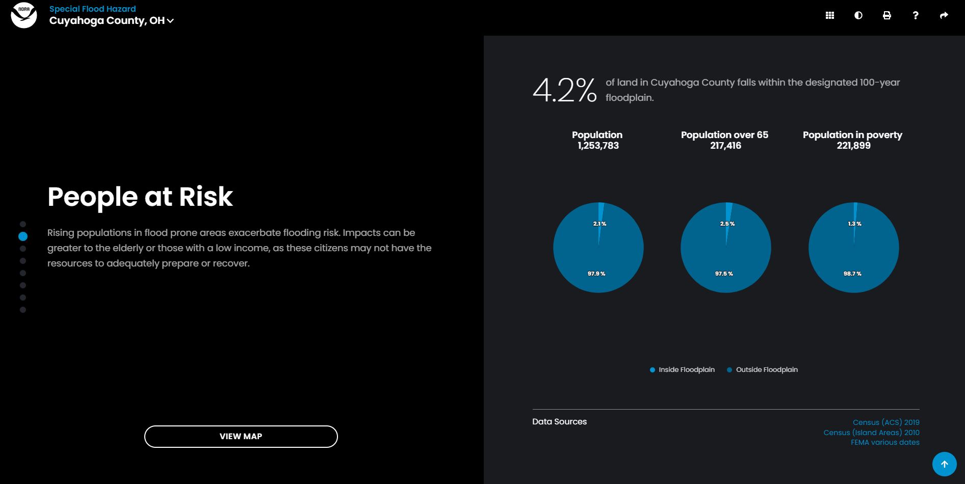
Snapshot topics include flood exposure, marine economy, total economy, and exposure to sea level rise.
Tell us how your county uses the snapshots.
Features
- Assess your county’s exposure and resilience to flooding
- Learn how your county benefits economically from the ocean or Great Lakes
- Examine the impact sea level rise might have in your county
Additional Information
Support
Tool Screenshots